We’re updating our website throughout the day with our latest thoughts (as opposed to spamming everyone with multiple e-mails).
However, here are the latest forecast thoughts as of 1:30 p.m. CDT:
The thick cirrus over much of Oklahoma and North Texas is hampering heating a bit. Models still don’t fully get storms going until 2-3, with the most obvious area for supercells being along the Red River Valley.
Wind shear in the lowest levels is very poor initially. This makes giant hail more likely and will keep the tornado threat very low until at least ~5 p.m. this afternoon.
Low-level shear will ramp up quickly from that point into sunset, but capping will increase, and storm mode will likely tend to be more clustered or linear with time. Any isolated and dominant supercells will pose a locally enhanced tornado threat along their paths this evening. Still, the degree of capping may help limit the overall threat to just a couple of storms.
Most of the team is targeting the Red River Valley on today’s chase.
Stay tuned to our website for the latest field updates through the day!
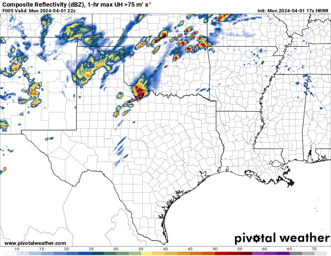
Image: The latest run of the HRRR weather model showing its projected storm locations as of 5 p.m.:


Thanks!!