


Ridge Isn’t Going Anywhere
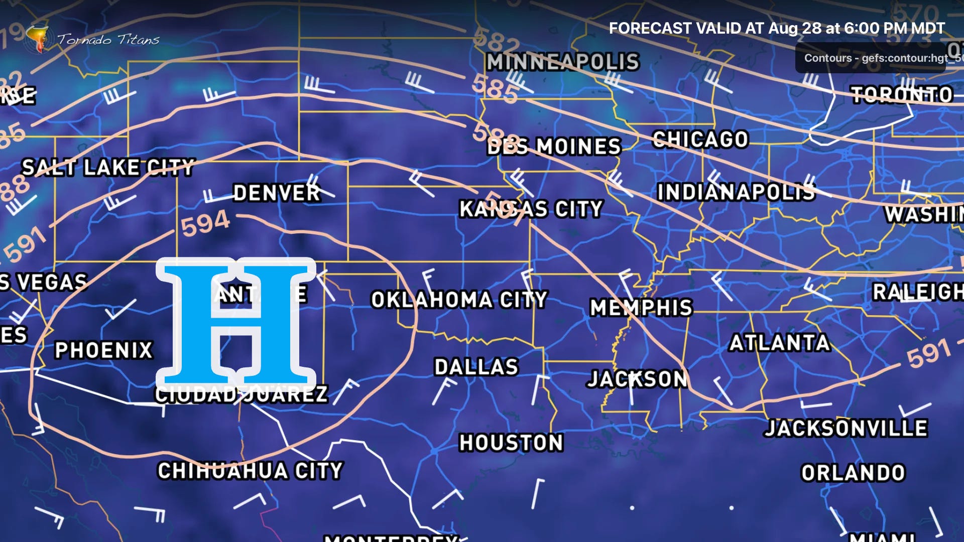
Persistent Ridge: Nothing has moved the ridge off of its perch in the Southern U.S. over the last 3 months now. We’ve had wobbles of the ridge, even slight weakening at times, but it has persisted and dominated the weather pattern over the U.S.
Drought Rising: This has led to ever-more dire drought conditions across the middle of the country, back into the Southwest -- where monsoon rains have, so far, been hit-or-miss.
Long Term: I'm not seeing much in the name of signs that this ridge is going to fully break in the coming couple of weeks. However, as we move into September, ensembles are beginning to weaken and flatten out the ridge.
See the full story.
TitanTrack Tool Tip
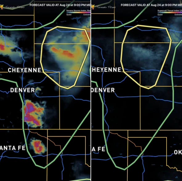
The difference in SSI (Base) and Supercell Threat Index is in the formulation, of course — SSI base is basically answering the question: Storms? A few severe ingredients? PAINT!
It’s a bare minimum calculation that’s helpful in patterns like these with monsoon-ish vibes. It’s sniffed out severe storms out here in ‘no risk’ situations many times already this summer.
On the other end, the Supercell Threat Index is looking for more overall, and it’s always going to show lower, and sometimes 0, where SSI is pretty hot. It’s asking: Storms? UH? Strong UH? Supercell ingredient stack? If yes, PAINT!
It’s kind of brutally simple, but it combines how I approach a chase forecast with a single field. They inherit all of the limitations of the REFS model, of course, so if you get bad data in, these are going to combine that bad data into bad data out. I’m not here to claim 100% accuracy, just a 100% shortcut for those looking for a quick glance on any given day.
Learn Mesoanalysis While Using TitanTrack
Programming Note: While we are increasing the frequency of newsletters once again — this author will be going on a well-deserved vacation this next week (weather permitting). So expect no newsletters next week, but when that ridge is breaking down you’ll likely hear from me about all of that in early September.