Today: Kansas-Oklahoma Tornado Threat 🌪️
Today: Kansas-Oklahoma Tornado Threat 🌪️
We’ll be live in the field, here’s how to watch
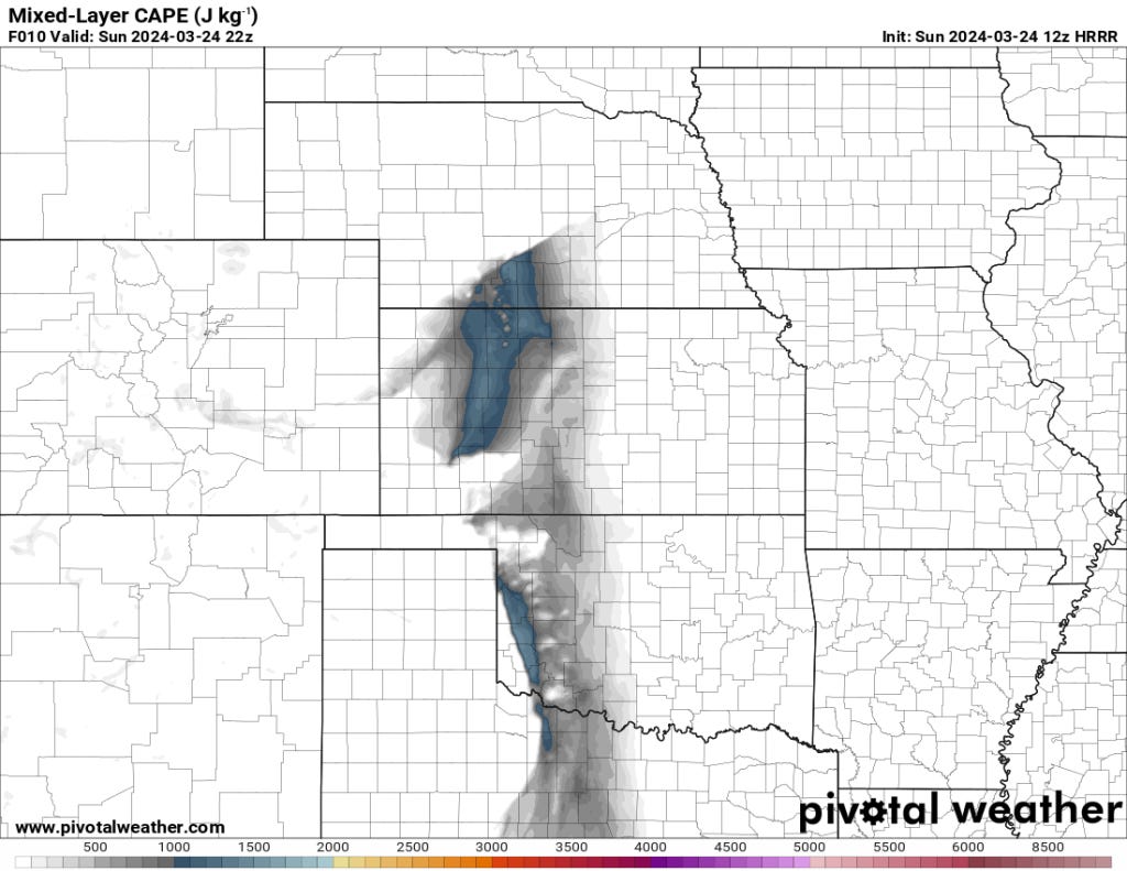
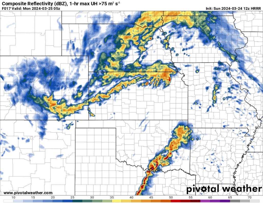
A Slight Risk of severe thunderstorms exists over parts of the Central and Southern Plains today and tonight. The primary threats are large hail, damaging wind gusts, and a few tornadoes.
Join us for Live Storm Chasing
We’ll be live in the field later today. Assuming no bugs happen in the system you can tune in directly at this link. Alternatively you can visit our channel, subscribe, and enable notifications so you know when we go live all season long:
Location
Central and Southern Plains, including portions of:
Oklahoma
Kansas
Texas
Threats
Large hail
Damaging wind gusts
A few tornadoes (highest risk during the late afternoon and early evening)
Timing
This afternoon through tonight
Discussion
Weather Systems
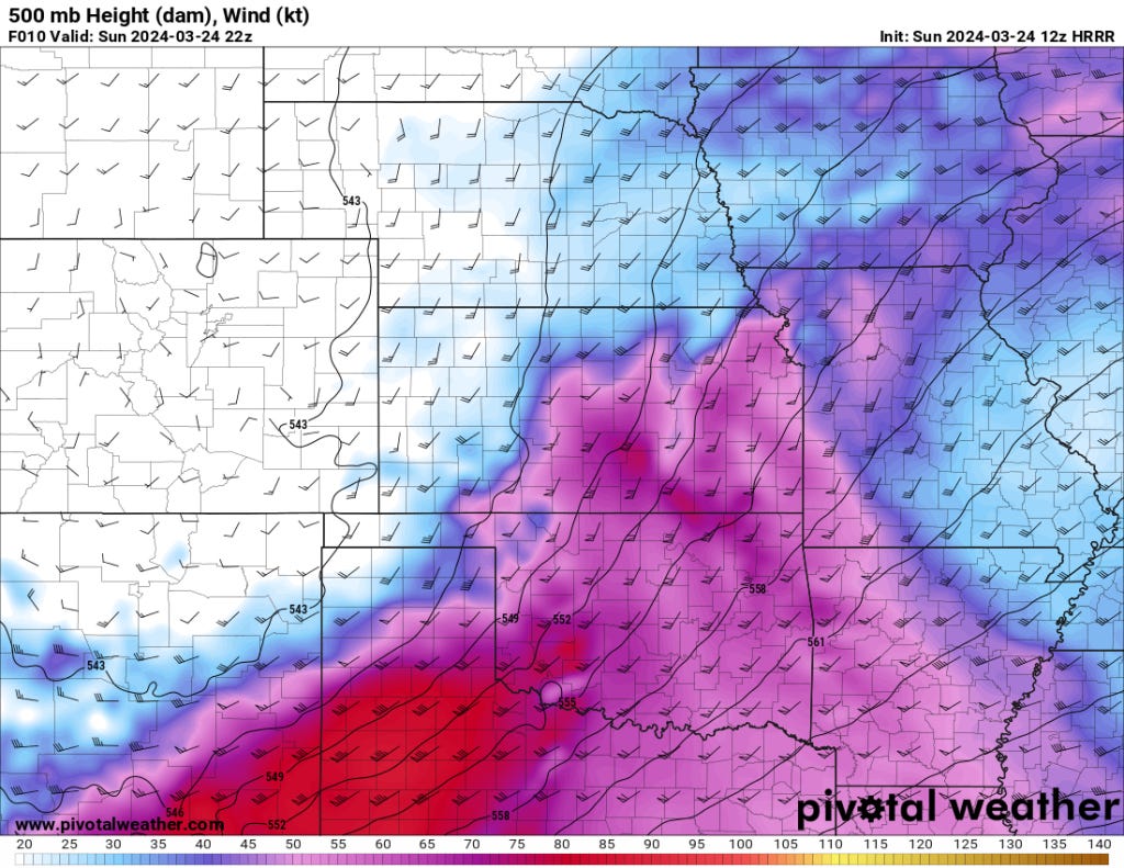
A deep upper-level trough moving across the West will drive storm development across the Plains states.
A surface low over the High Plains and a dryline will act as focal points for storm development.
Storm Evolution
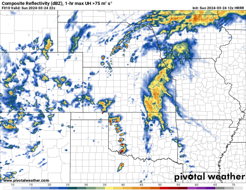
Isolated supercells are likely near the dryline this afternoon, posing the main threat of large hail, gusty winds, and potentially tornadoes.
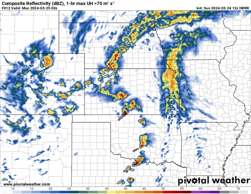
Tonight, additional storms could form as the dryline interacts with an approaching Pacific cold front. While these storms can still produce severe risks, they may weaken somewhat overnight as the atmosphere stabilizes.
Uncertainties
Localized areas of heating and moisture will be critical factors in determining where the strongest storms occur.