

This Active Pattern Will Continue
This Active Pattern Will Continue
It seems like a parade of storm systems has been ongoing for a couple of weeks now.
We’ve had several pretty strong storm systems push through the Southwest and into the Southern/Central Plains. And looking ahead, it seems like we will keep that up as we move towards February. Let’s take a look!
The ‘Official’ Forecasts
The talented folks at the Climate Prediction Center put out their temperature/precipitation outlooks for the next several months. But I’d like us to focus in on the more immediate outlooks.
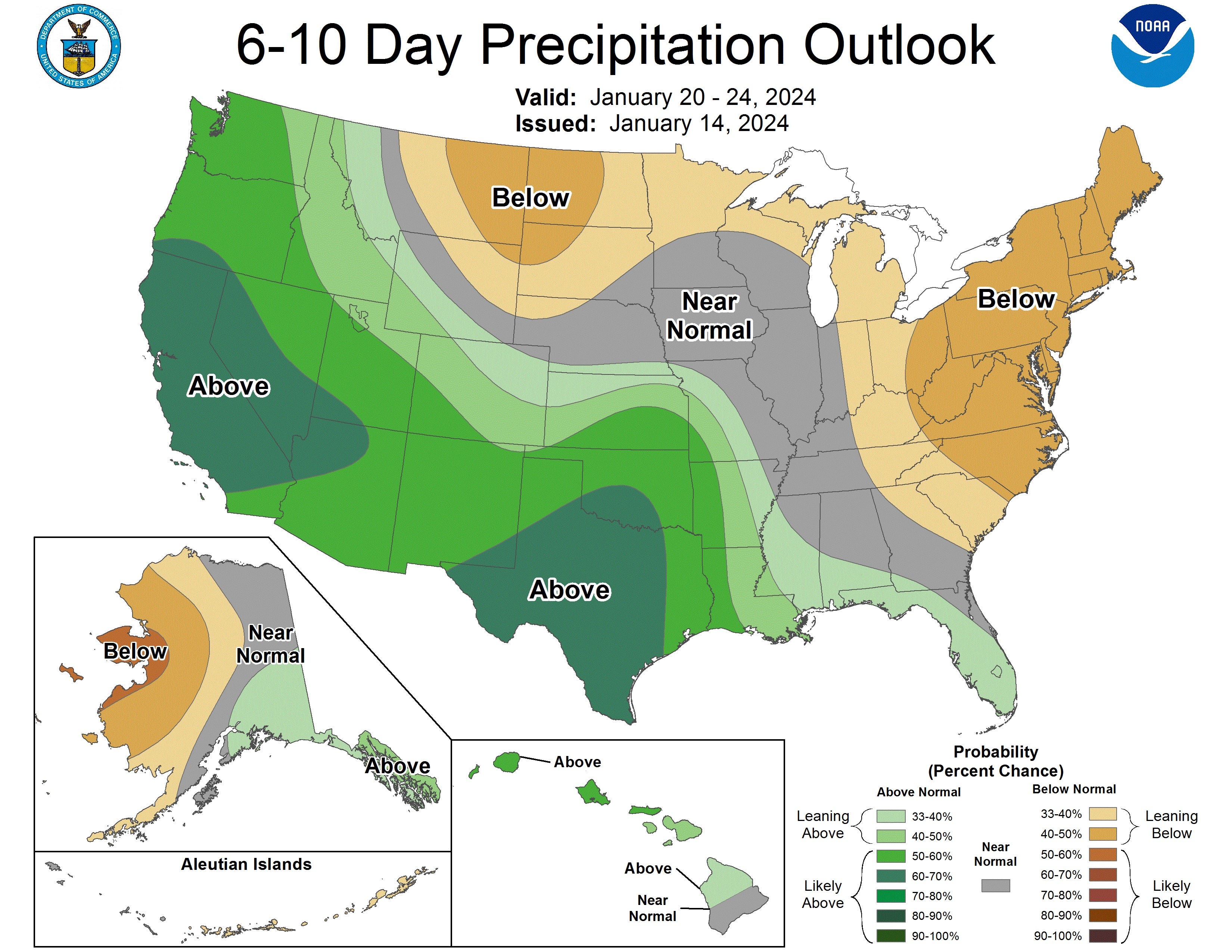
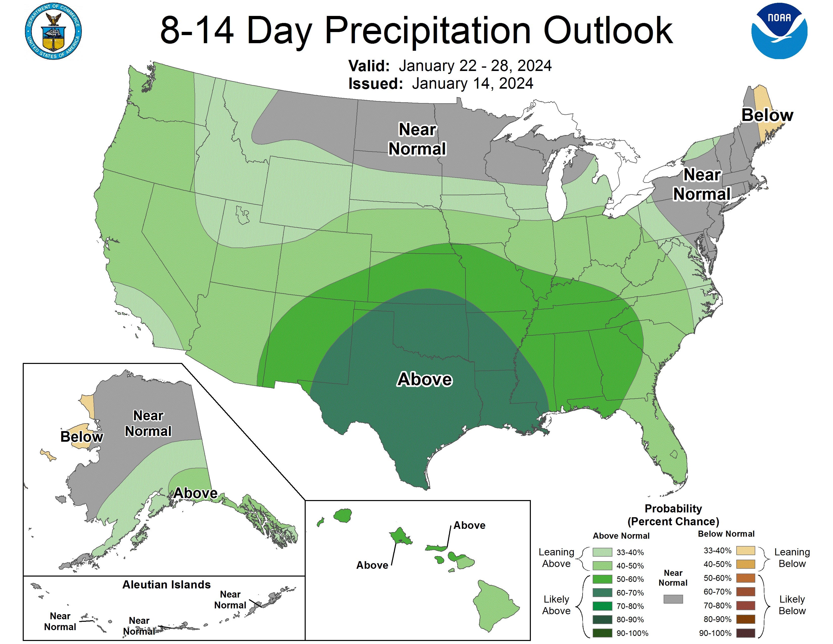
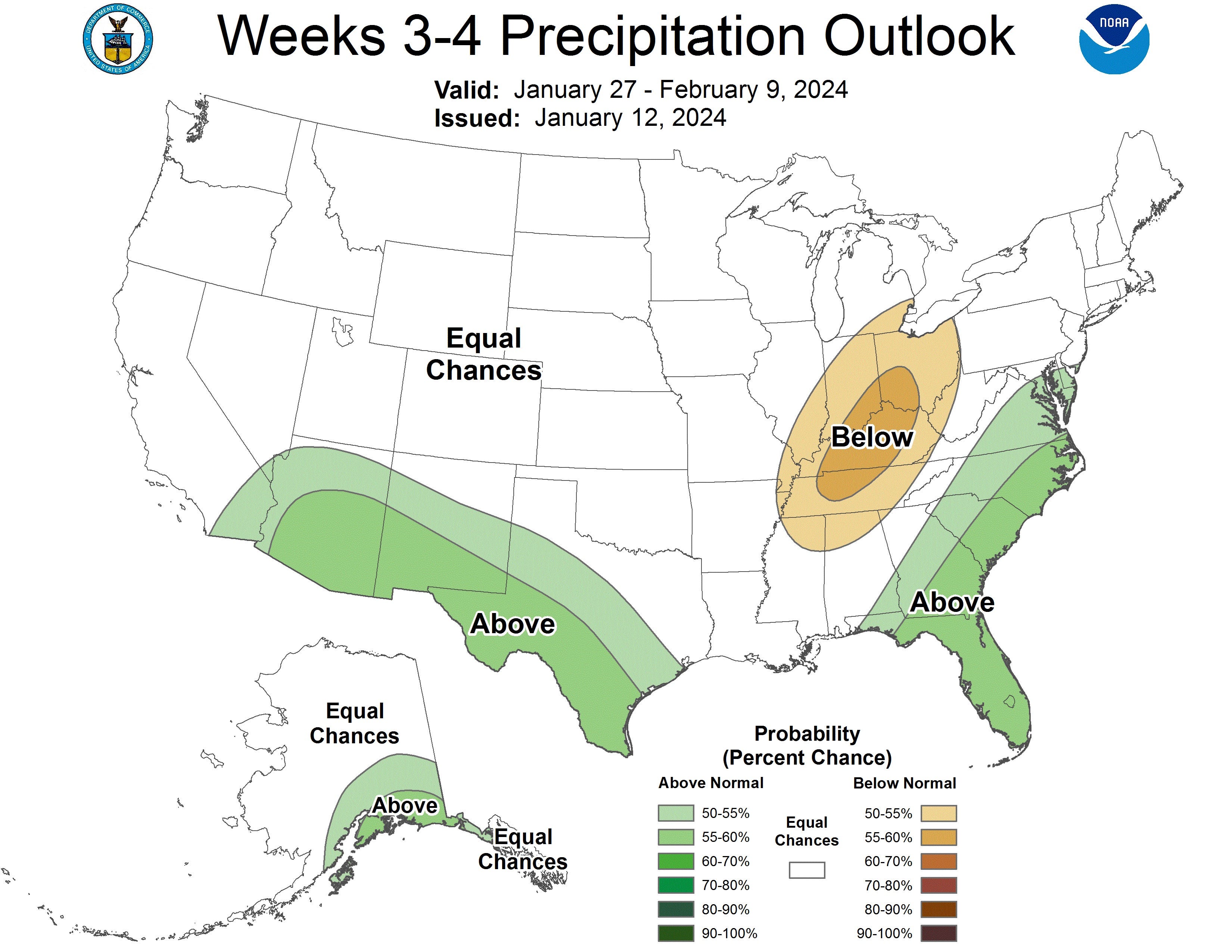
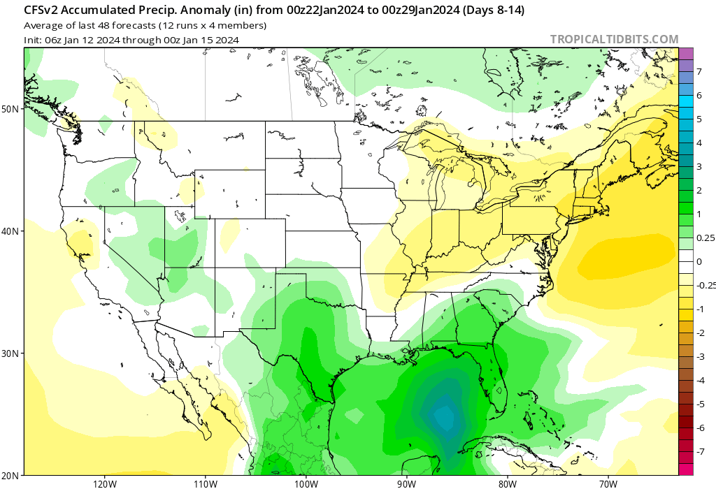
What Do Models Say?
Forecasting at long range like this is always tricky, and models are just one tool. However, an obsessive model watcher can spot patterns/trends indicating where things are heading. Here are some thoughts:
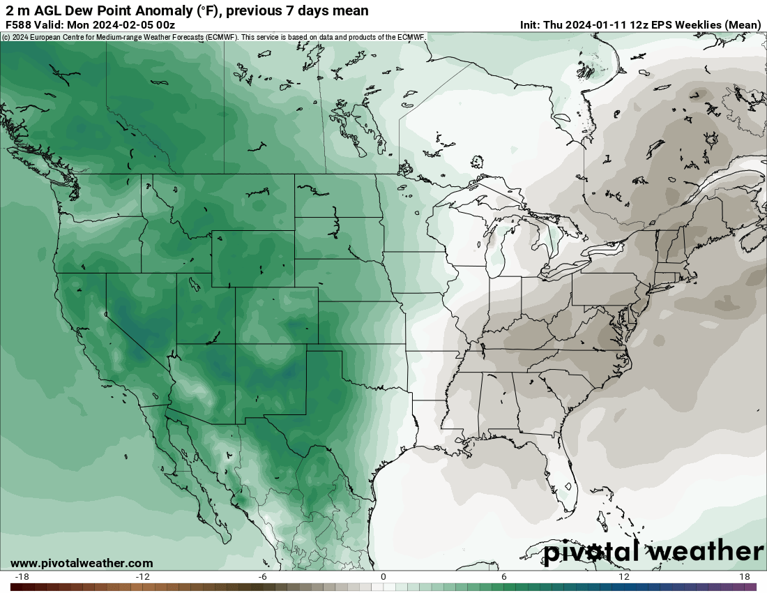
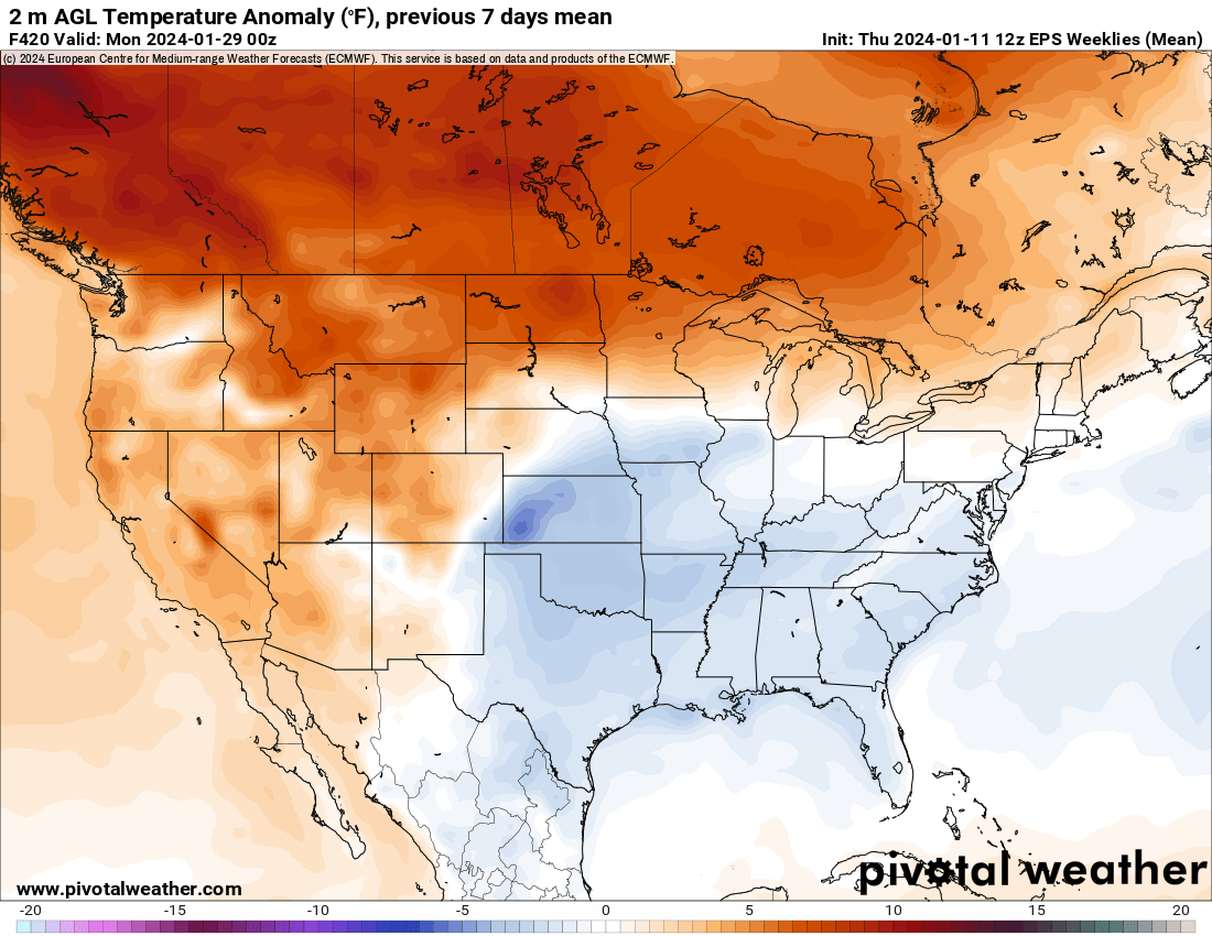
Overall Thoughts: Rainy/Snowy But Not Severe
El Niños are notorious for often being slower severe weather years to start. With cold fronts continually pushing into the Gulf of Mexico, you are seeing some of the reasons why, shunting the tropical moisture even south of the Yucatan peninsula.
As we move into late January into February, we will see several storm systems with lots of rain and snow impact the country. There will be some severe weather risks to be sure if enough moist air can be drawn north, but overall, I’m seeing favorable trend lines to get rid of drought before us storm chasers are out in full force in a few months.
Breathtaking Storm!
Our target for this day was Amarillo, Texas.
The environment was indeed pretty souped-up, which is typical of mid-May. At the beginning of the day (May 18, 2023) -- lots of storms went up at once just east of a surface trough. This was discouraging at first because I honestly feared that we wouldn't get a supercell, given the near-constant storm interactions. But, as it turns out, that is precisely what we needed to get a supercell.
What came next with this storm was one of the prettiest storms of the year in Tornado Alley.