

The Fall Season Comes to Kansas
The Fall Season Comes to Kansas
A look at a severe weather risk tomorrow + some education!
So far the pattern has been pretty dormant for the Fall season with risks staying north of the central and southern Plains into the Southwest. Tomorrow could be a chance at some severe storms along a sagging front in Kansas and there’s just enough of everything to indicate a rogue supercell could take shape with large hail and damaging winds the primary threat.
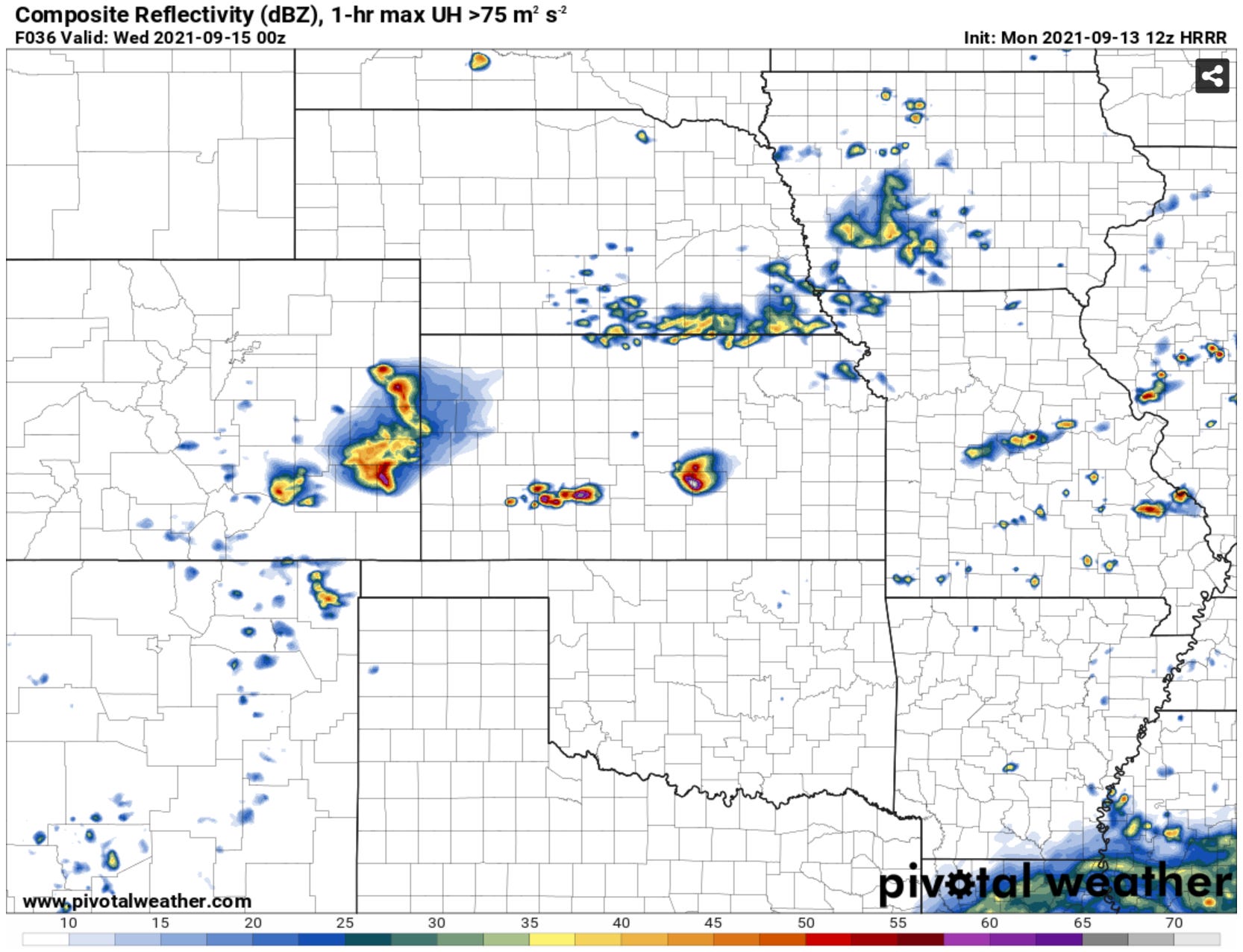
High-res models have storms forming in the late afternoon and evening from Eastern Colorado into Kansas. Some models like the HRRR hint at the possibility of a supercell (a rotating storm) in Kansas tomorrow.
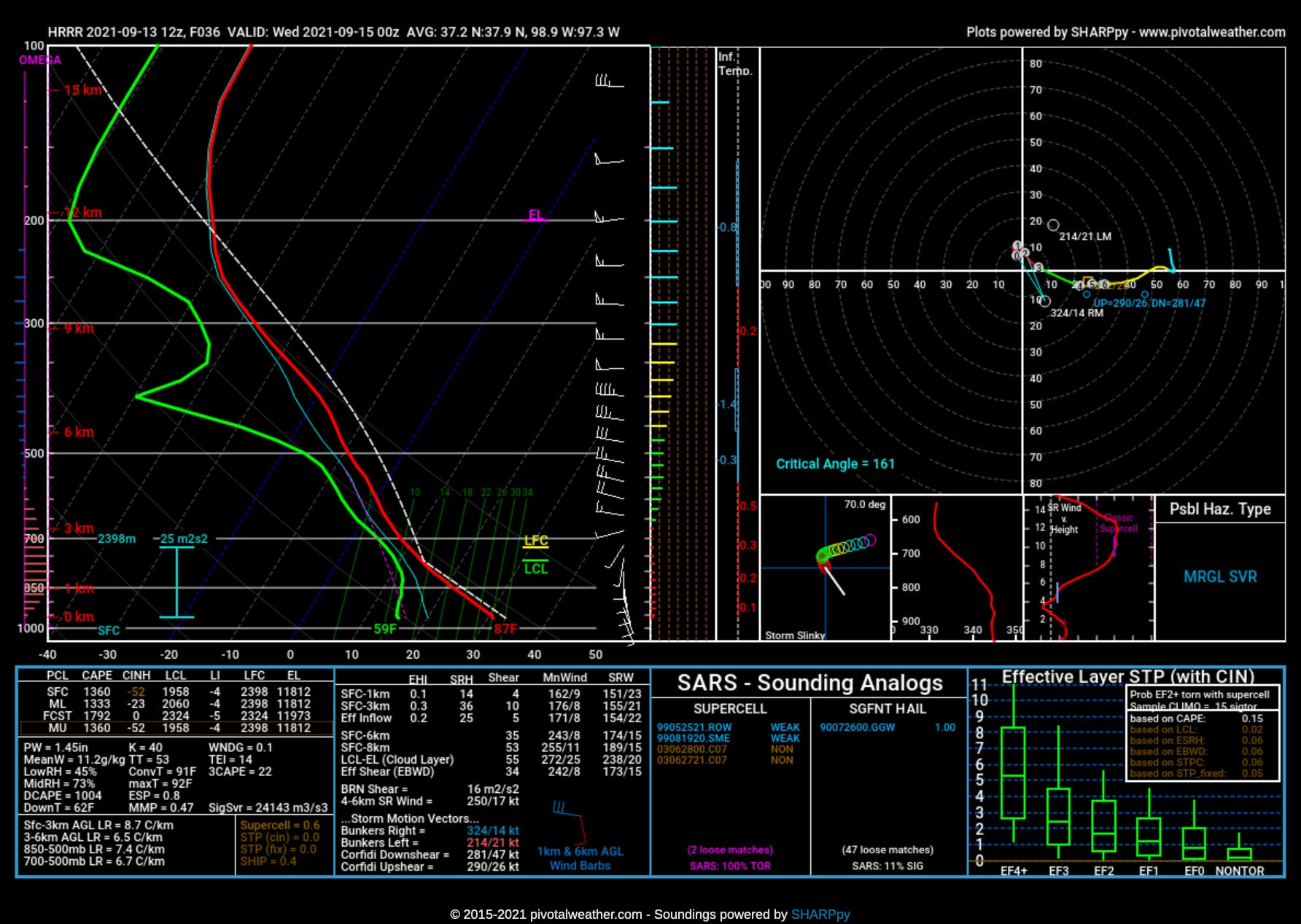
A forecast model sounding for tomorrow does indicate a decent amount of 0-6km bulk shear at 35 knots. The low-level wind field is pretty weak but southerly storm motions will enhance that relatively somewhat. The straight line on the hodograph is worrisome for getting a supercell, but the SSE storm motions may help there. It does not look like a photogenic storm producing hodograph though to be sure. Storm bases should be relatively high with an 87/59 spread. It’s a pretty low-end day, but as the months turn to September and onwards into winter we take what we can get.
Learn About How to Read the Skew-T Chart Above
Did the chart above have you like huhwut?
Good news! We have an educational course at Titan U for that! Check out our course by clicking the image below or this link right here.
