After what was finally an active June on the Central and Southern Plains, a throwback to prior decades where such a thing wasn’t uncommon, it looks like the weather will continue to make some sense for a bit as the summertime pattern continues to expand to more areas.
Thanks for reading Tornado Titans! Subscribe for free to receive new posts and support my work.
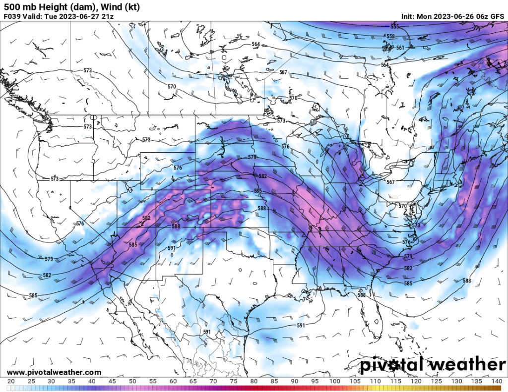
By tomorrow, a ridge of high pressure will be dominant in the South-Central U.S. — but a wave riding over the top will be enough for severe weather on the Central/Southern Plains.
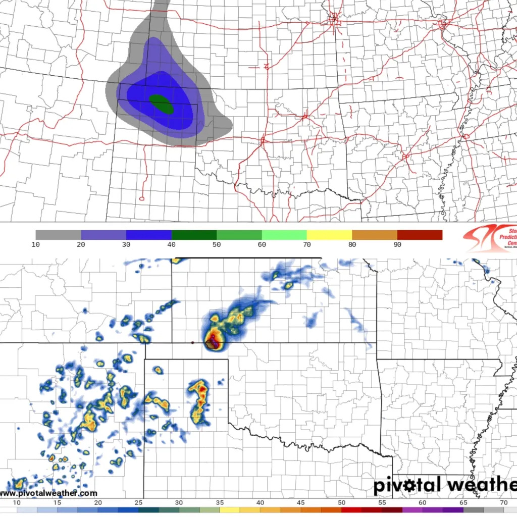
Models have a pretty good handle on this, developing robust storms from SW Kansas into the Panhandles region. Large hail will be the main threat (some giant hail possible) but I wouldn’t rule out a rogue tornado or two if you have a robust supercell in the evening.
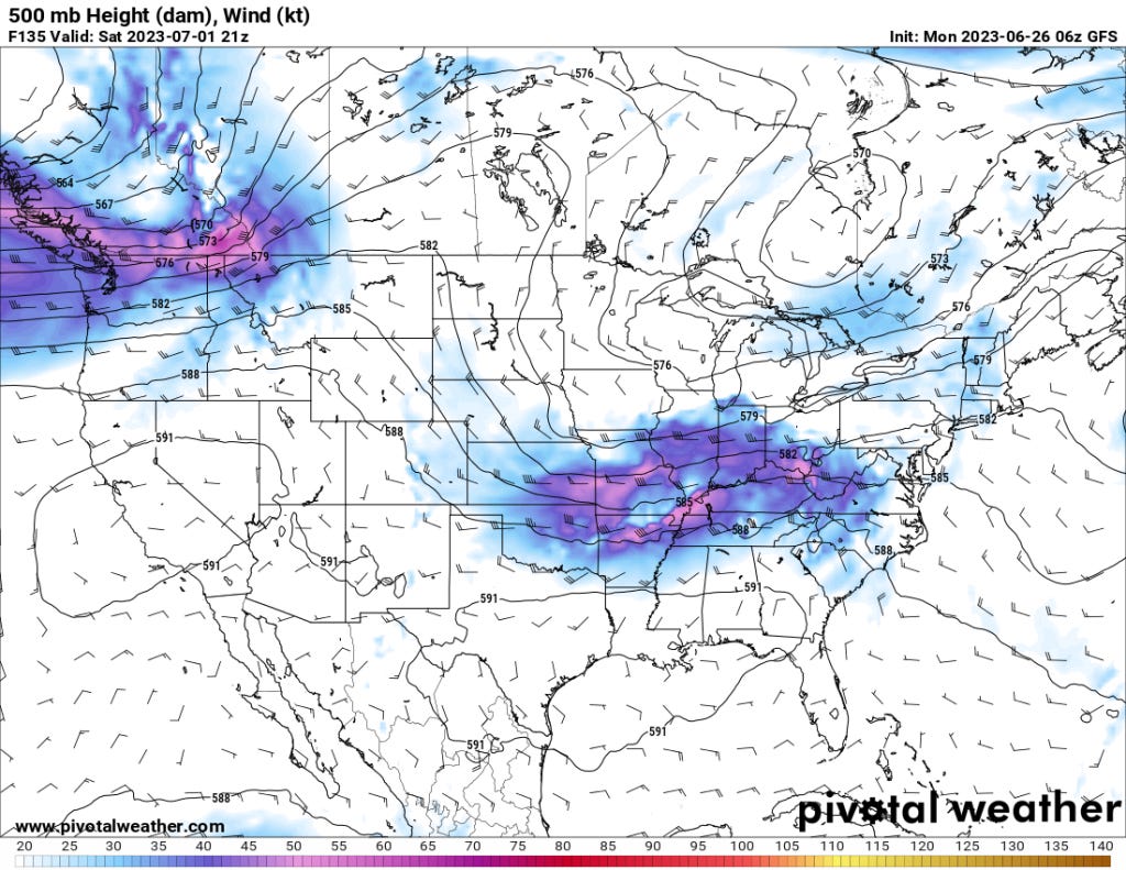
The ridge will flatten in the South-Central U.S. some this weekend, allowing for a cold front to dive south. Expect some severe weather risks along and ahead of this front as it moves through Oklahoma before eventually stalling and washing out in Texas.
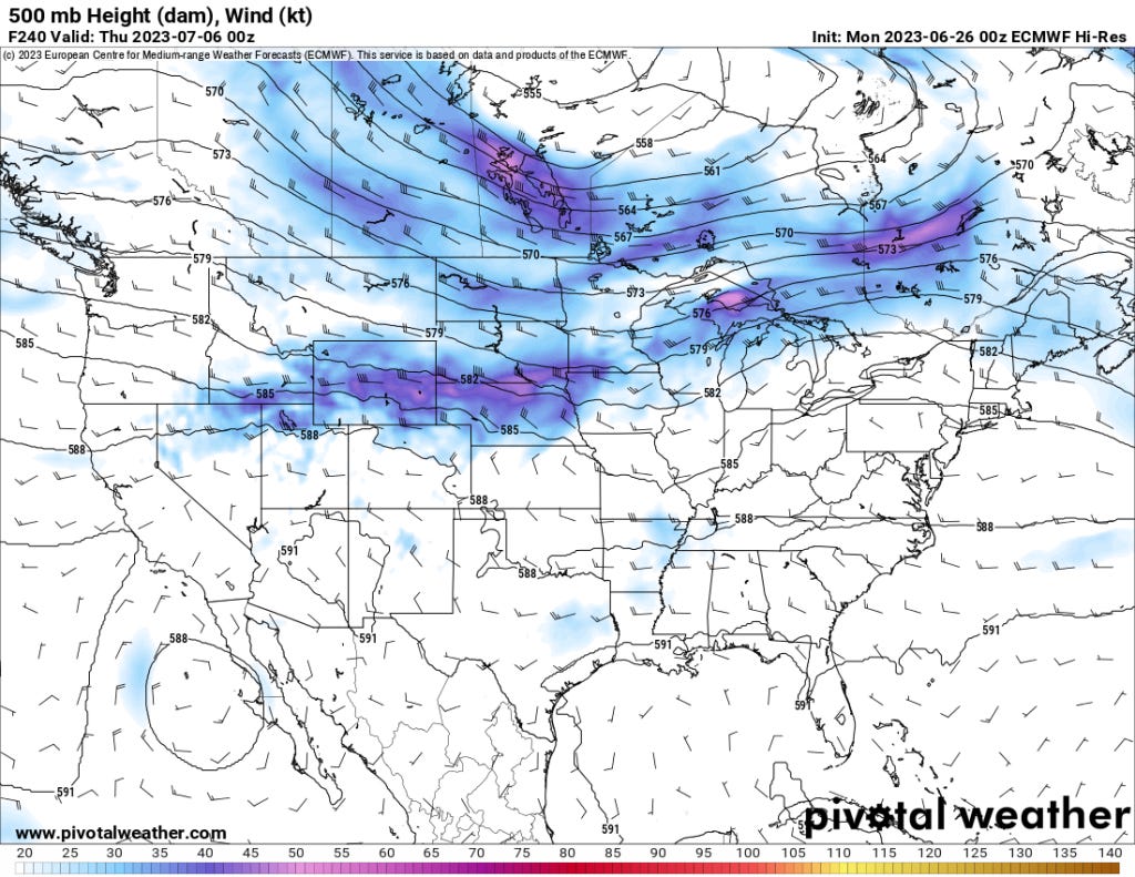
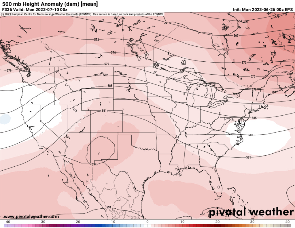
As we look ahead into the next week, the ridge will be centered more over the Southwest U.S. — there will still be some flow from I-70 and north in the Central/Northern Plains which will likely be where most of the severe weather activity is centered in the first 1/2 of July.
Ensembles support this idea with general and broad agreement on ridging building in, pushing the jet stream northwards this next month.
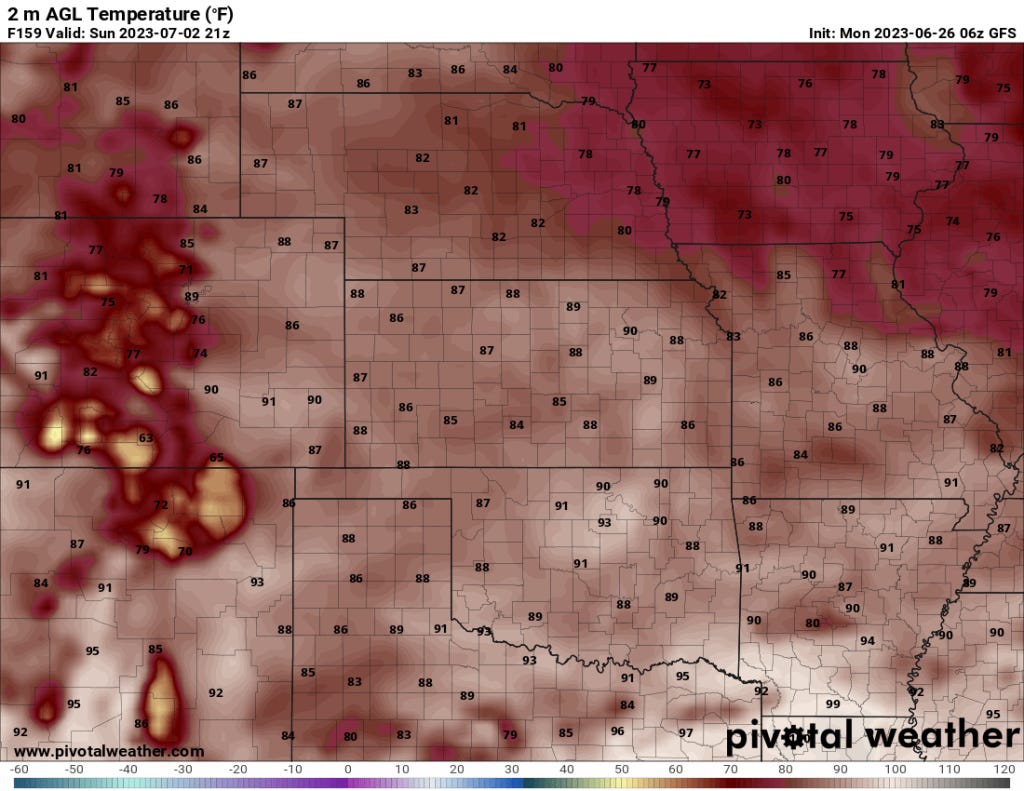
The main story for the region we focus on most (Southern/Central Plains back into the Southwest) will be the ongoing heatwave which continues to prompt heat advisories and excessive heat warnings.
However, relief is on the way by the weekend for portions of the Southern-Central Plains with much cooler temperatures as far south as the DFW metroplex.
This week isn’t going to feature that many super robust severe weather threats across much of our focus region — but there will be threats and severe weather warnings (and likely watches).
However, it is now very clear we are moving into a more summertime pattern with the jet stream flow shifting north moving into next week. As we discussed in our summer outlook blog, I suspect we’ll see the ridge flatten out from time to time. This will bring some flow (likely NW’ly or W’ly) throughout the summer, with associated severe weather risks.
But in between those? Find ways to stay cool.
Thanks for reading Tornado Titans! Subscribe for free to receive new posts and support my work.