

⚠️ Severe Weather Tonight on the Southern Plains
⚠️ Severe Weather Tonight on the Southern Plains
And Next Week 👀
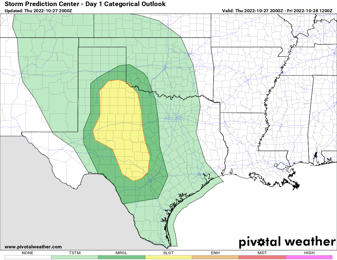
A few storms should begin forming today just before sunset across the E. Texas Panhandle into the Texas South Plains with more widespread storms overnight. Large hail is the biggest threat with storms but there is a very low risk of a tornado as well, though I think any tornado would be pretty fluky today. Storms will become more numerous overnight, with heavy rain likely in the Red River Valley and south into Texas. The severe weather threat should maximize from 7 p.m. to midnight.
You can read our full forecast thoughts on our website.
Next Week 👀
Listen there’s a lot of time for this to change but there has been a severe weather setup showing up for next week on the Euro and it has been pretty much on every run for a few days. I’m not going to lie, it looks like a legit ‘be there’ storm chase setup at this range.
This is probably going to change. But I do want this newsletter to be a place where we can share some of our insider thinking on setups that are even a week away.
The things that have caught my attention:
60 dewpoints make it into the target zone.
There is a lot of upper air support moving in.
Just enough capping to keep the weakest updrafts out of the picture.
The wind shear is more than favorable for severe weather.
Will it hold? I’m really not sure. The trend oftentimes with weather models is for setups to look very favorable days out and slowly degrade as you move towards it. There’s a lot of things that could go wrong at this range, so this is my invitation for you to follow us on all our social media channels as you’ll know our very latest thinking on there.