Severe Storms on the Plains Today
Severe Storms on the Plains Today
Expect severe storms from Nebraska to Oklahoma today.
A low risk of severe thunderstorms will exist this afternoon and early evening from Nebraska to Oklahoma. A powerful storm system will move east out onto the Plains with tons of associated lift. Storms should form from north to south through the afternoon.
Locations:
Southwestern and southern Nebraska
Central and eastern Kansas
Eastern Oklahoma
Threats:
Large hail (1 to 1.5 inches possible)
Damaging wind gusts (60-80 mph possible)
Very low to low tornado risk. Relatively highest early near the low in Nebraska/North Kansas and then a very low risk in Eastern Oklahoma in the early evening.
Timing
This afternoon through early evening
Discussion
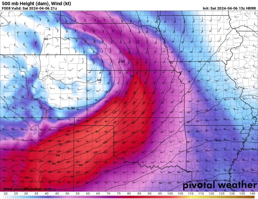
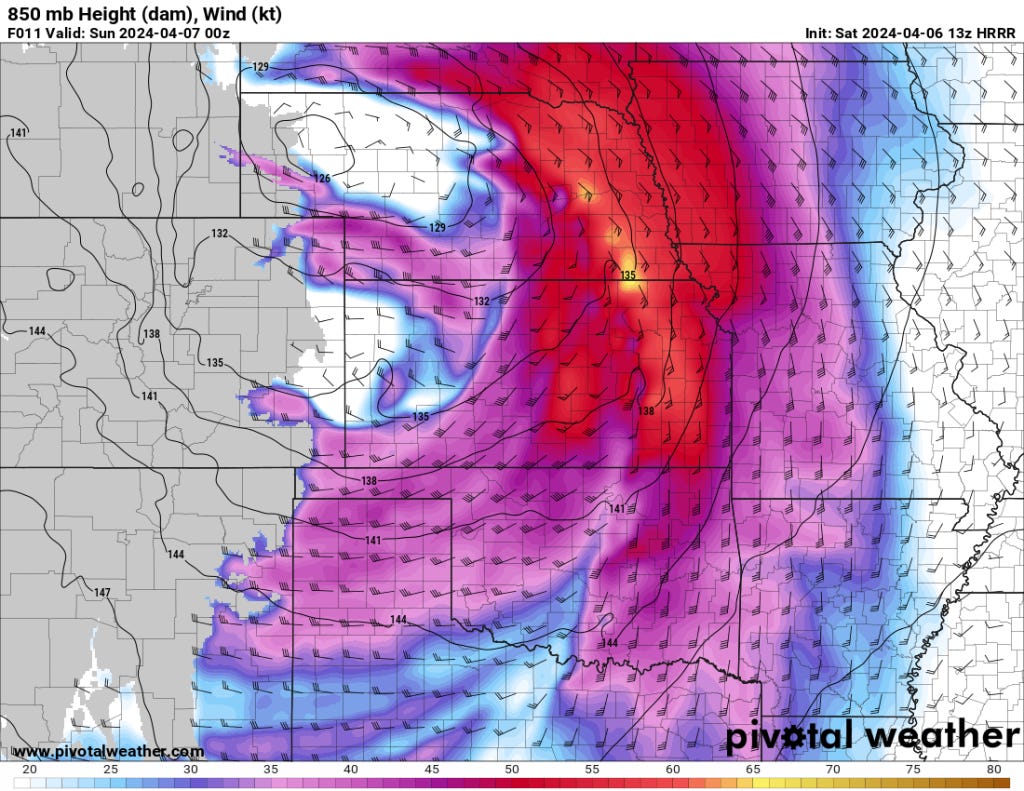
Weather Development: A powerful upper-level disturbance is pushing into the Central Great Plains, accompanied by a deepening surface low.
Northern Storm Type: Expect initial development of a few potentially supercellular storms, before transitioning into a more linear storm mode in the north.
Southern Storm Type: Further south, as a pacific front and dryline consolidate and move east, storms should form in the late afternoon. These will be a mix of multicells and supercells.
Limitations:
Limited moisture (low dewpoints) will restrict the overall intensity and coverage of severe weather in the north.
Moisture is also not excellent to the south, but 60 dewpoints will be nosing north in the early evening in Southern Oklahoma.
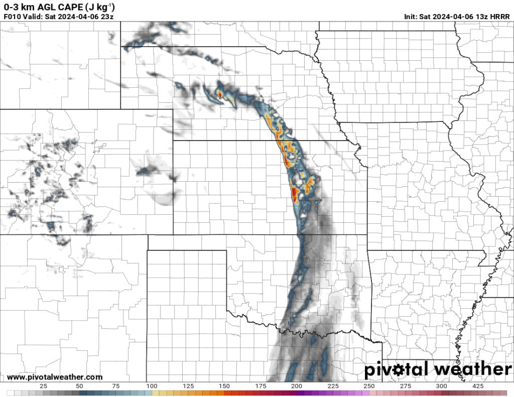
Instability will be weak, further reducing potential storm strength.
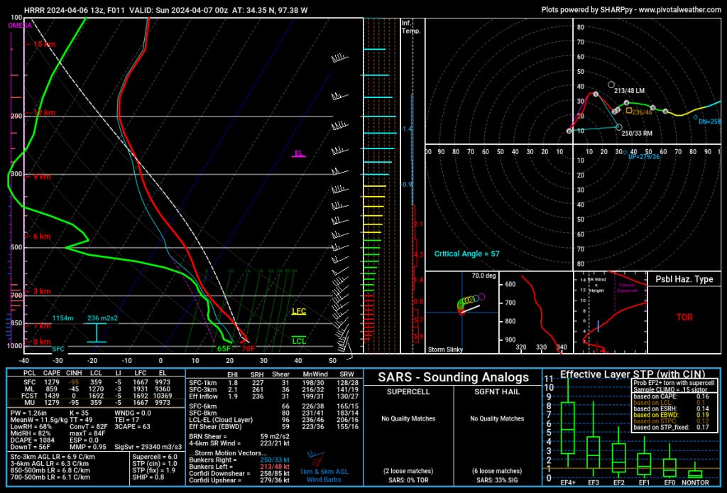
Technical Discussion