

⛈️🌬️⚡️ Plains Severe Threat Today/Tomorrow
⛈️🌬️⚡️ Plains Severe Threat Today/Tomorrow
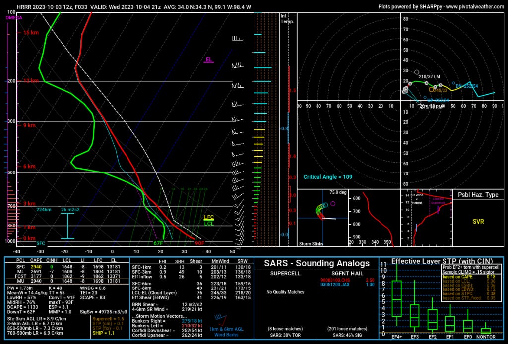
Damaging winds, giant hail are the main threats from Nebraska to Texas.
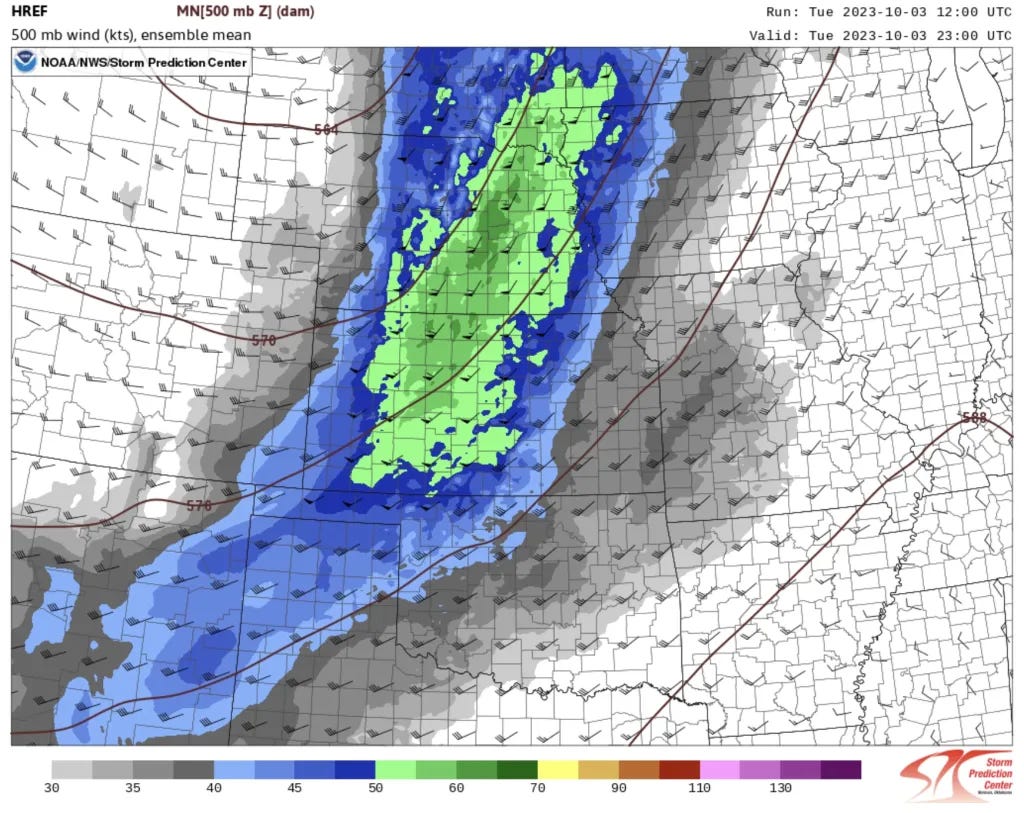
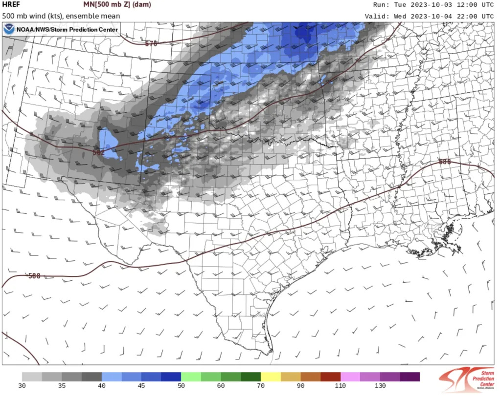
A storm system is pushing north into Canada, with a trailing cold front and enough upper energy to touch off some severe weather today and tomorrow. Today, we will focus more on Kansas and Nebraska, with tomorrow’s action in Oklahoma/Texas. Let’s dive in.
Today
A storm system is skirting the Plains, but it is dragging a cold front down that will be a season changer. This pattern is part of a broader reset that will send us into the cool season in earnest.
The Bottom Line for Today
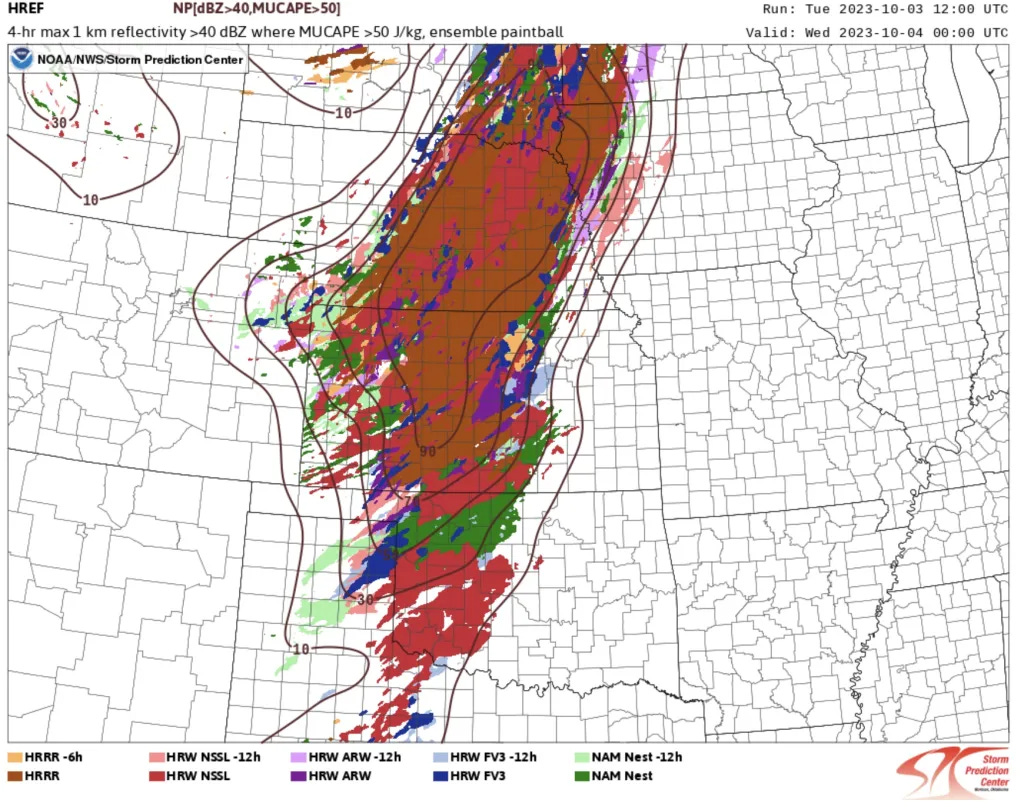
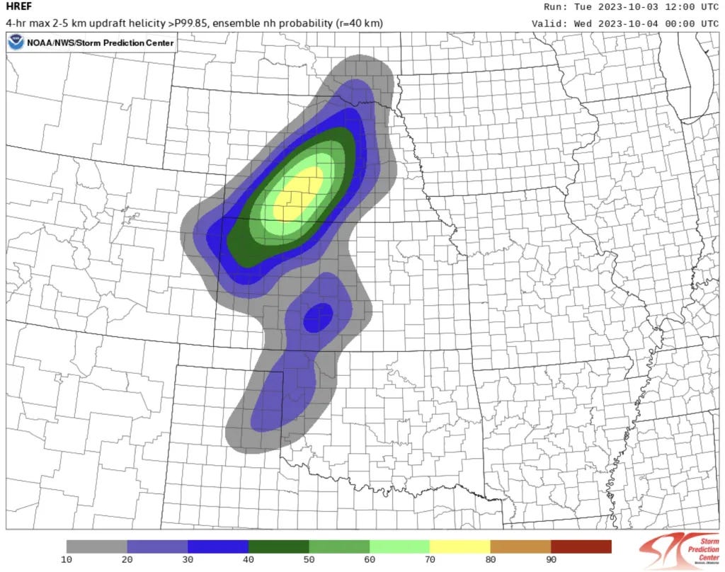
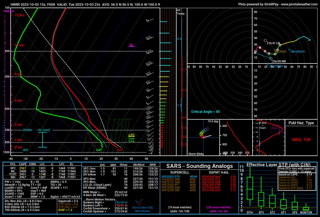
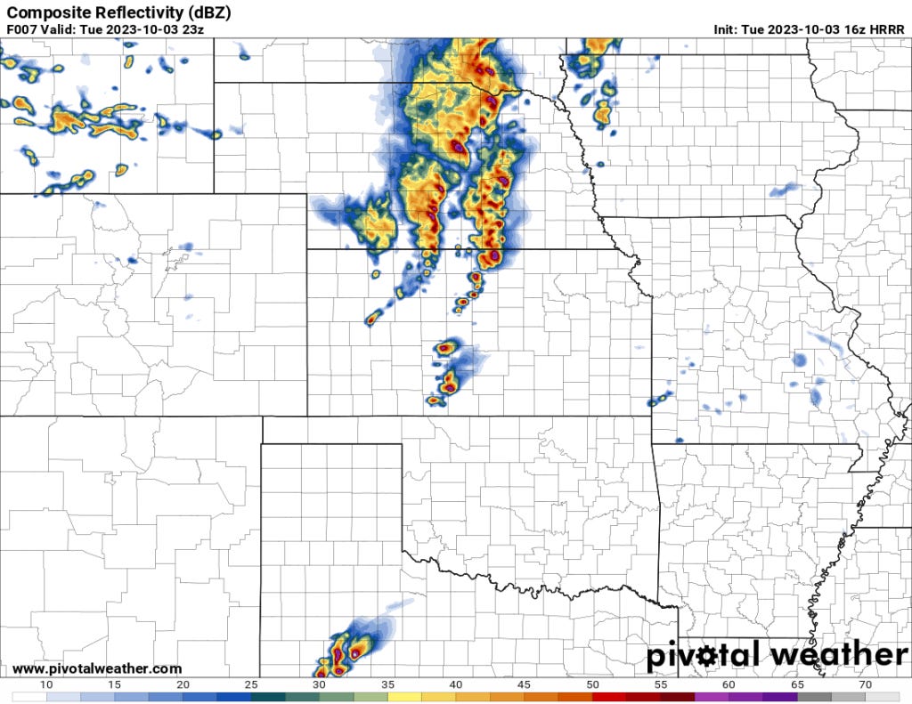
It seems obvious we’ll have a robust severe weather threat across Central/Northern Kansas into Nebraska. Storms will be ongoing much of the afternoon into the evening with a large hail and damaging winds threat. The tornado risk is low.
Further south, I think the diffuse nature of the dryline mixed with drier air aloft mixed with veering low-levels that I see on surface obs means storm initation from Southern Kansas to the Texas South Plains is more uncertain. The likely scenario is this area stays dry until at least sunset.
An Early Look at Tomorrow
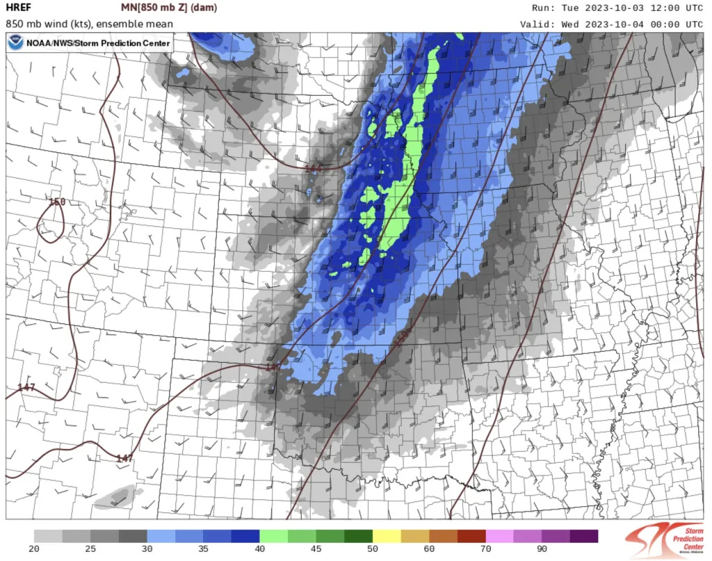
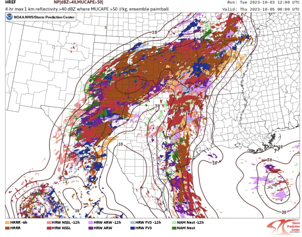
Storms will form early tomorrow, seemingly everywhere. I think just on storm coverage alone, we should see an enhanced risk. Hail and damaging winds will be the primary threat — the low-level flow, in particular, is very anemic so I don’t see much of a tornado risk.


The Bottom Line for Tomorrow
Tomorrow is the prototypical severe weather threat day that’s going to see a lot of blue (wind) and green (hail) dots on the storm reports map but few if any, red (tornado) dots. Early on in the storm’s life-cycle (11 a.m. – 3 p.m.), giant hail will be possible. That will transition over to what might be a significant damaging wind threat as the MCS accelerates south and east across Oklahoma and North Texas.
There is a very low, non-zero tornado risk — but any such events must be embedded within the line or from fluky storm interactions early in the day.
Looking Ahead
The pattern resets in a big way, and we will likely see severe weather chances taper off on the Plains for a good while under dry NW flow aloft. I’m not seeing any apparent patterns in the next 7-10 days beyond this one to indicate there’s even a small risk of severe storms on the Plains.
You can follow us on YouTube (subscribe at the button below) to stay on top of our latest video content. I may go live today and tomorrow to talk these setups in real-time. I’d love to see you all on there in the chat!