
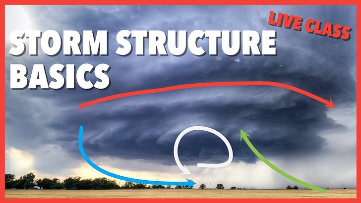
Live Class Tonight at 8 CT: Storm Structure Basics
Live Class Tonight at 8 CT: Storm Structure Basics
Also check out our newest video on YouTube!
We’ve never done a live class before, so tonight we’re trying something new! We’ll diagram 8-11 storm pictures in real time, talking about the different pieces of the storm and things to look for using an image editor. Afterwards, we’ll make sure we send a special link to all of you with the finished products!
Set a reminder at the link below:
This Supercell Looked Wrong
My storm chase on May 4, 2022 did not start off well to be honest. I woke up with food poisoning in Oklahoma City which meant that I was going to have a pretty tough time pulling my most aggressive chase off considering I had to end my day in Albuquerque, New Mexico to be back at work the next day.
So with that in mind, knowing I couldn't target the place I wanted to target for this chase, I tried to target an interesting and small pocket along a warm front that was draped north of Childress, TX, closer to Memphis and east into Oklahoma.
The storm structure west of Memphis was very interesting and I take some time in this video to diagram it out, as this is a very typical storm structure on a warm front with lots of cold air on the north side.