

Ice Storm Time on the Southern Plains?
Ice Storm Time on the Southern Plains?
A system in tonight and into tomorrow morning will cause some issues.
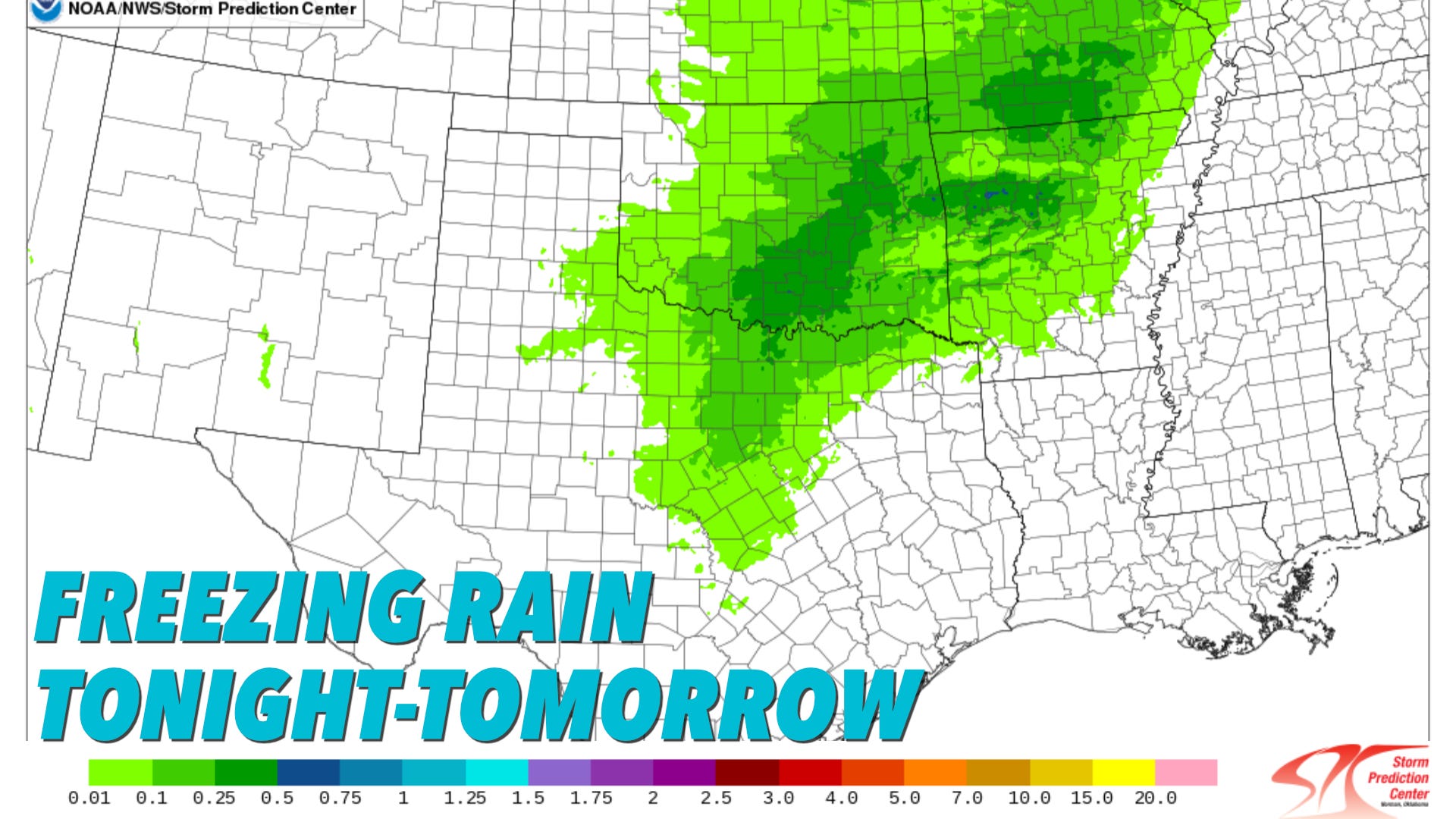
We haven’t yet had an ice storm this winter, but that lucky streak seems set to end tonight and continue into tomorrow morning, with problematic amounts of ice expected for some areas.

This Is An Impactful Storm, But Not Extreme
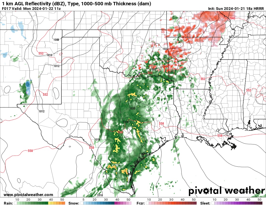
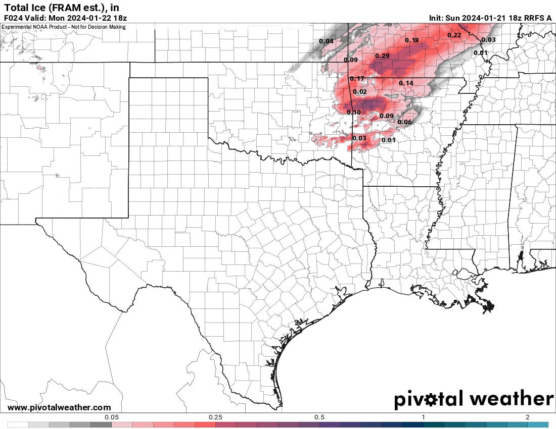
A wide swath of very light icing will likely be on elevated surfaces. Within that, where stronger convective cores move through, localized swaths of higher ice totals could be possible. Quarter to half-inch ice accretion is enough to bring down some weaker tree branches and powerlines. Thus, power outages and some property clean-up headaches are possible.
Watch our live briefing from this afternoon.
The most likely area to see impactful ice will be in that southern/eastern Oklahoma into NW Arkansas and Missouri area in our region. Western Illinois could see a significant icing event extending back to St. Louis.
One concern is for bridges to ice over for the morning commute. No vehicle stops well on ice — a concern before temperatures warm tomorrow morning.
The Latest Data Is Less Bullish
Admittedly, I’m happy I waited a bit to write this post because the afternoon runs of high-resolution models have come in slightly higher on the surface temperatures. This would be enough to limit ice coverage if it comes to pass. I consider this the low-end possible scenario for this system.
Overall, This Will Be an Active Week
This is a great week to check out TornadoTitans.com daily for the most up-to-date information on each small system that runs through. There is even a marginal risk of severe weather on Tuesday. We won’t be short on things to discuss this week, for sure!
There's not much else you can say about May 24, 2011, except that every index you look for to get tornadoes on the Southern Plains was at or near max levels. Deservedly, the Storm Prediction Center issued a high risk for this day, and the results bore out the incredibly maxed-out atmosphere from Southern Kansas all the way to North Texas.
Our target on this day was west of Oklahoma City. Everything pointed towards significant tornadoes close to/near the metro area on this day. After seeing the EF-5 form near Hinton, we moved south fast to capture two more violent tornadoes. Had the raters been more ambitious, we might've been some of the only people ever to see three EF-5 tornadoes in a single day.
It will not be long and it will be tornado time!