

💨 Enhanced Threat of Giant Hail, Very Damaging Winds
💨 Enhanced Threat of Giant Hail, Very Damaging Winds
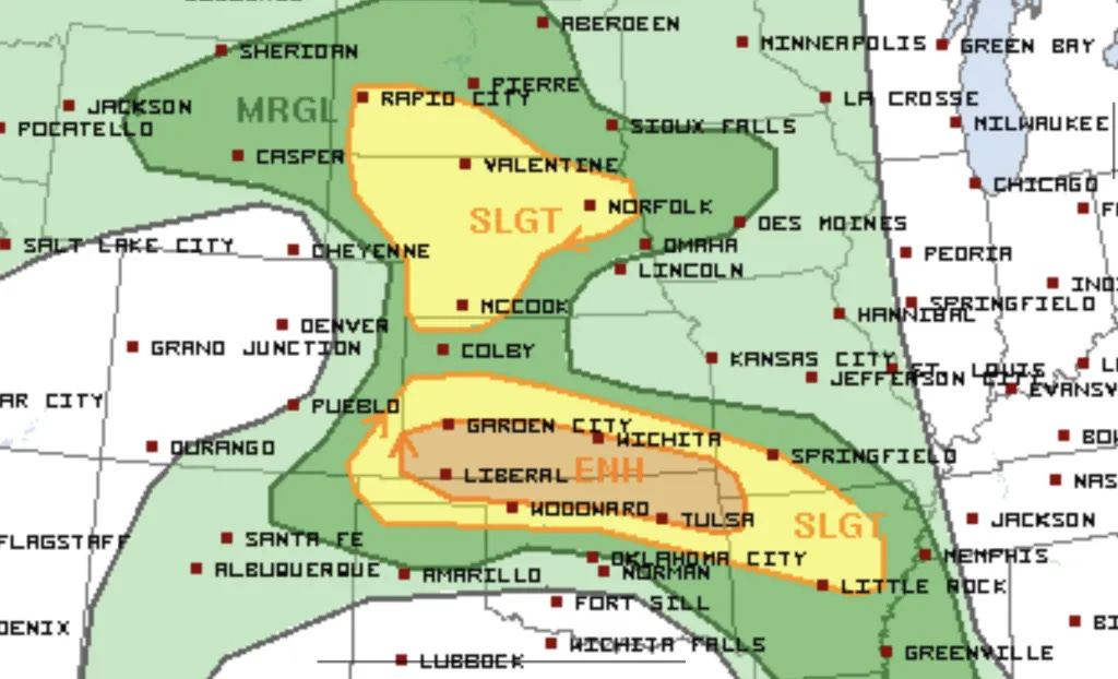
Oklahoma and Kansas may see some giant hail and 80+mph winds today/tonight.
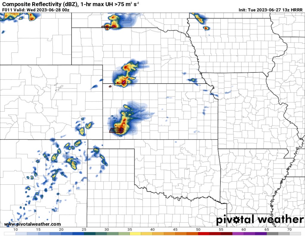
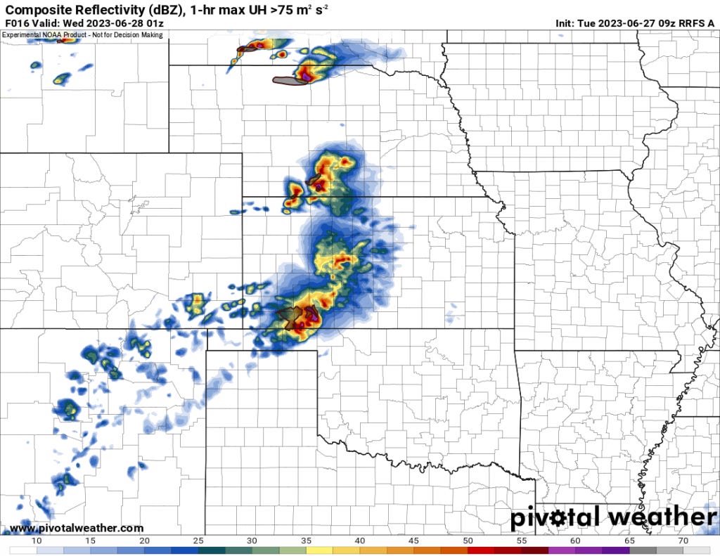
It seems like folks in Oklahoma and Kansas are waking up to severe storms every morning, and we are looking at yet another overnight threat tonight. But before then, as storms initially form, we should expect some pretty severe weather from SW KS into the Panhandles and then east from there.

The Bottom Line
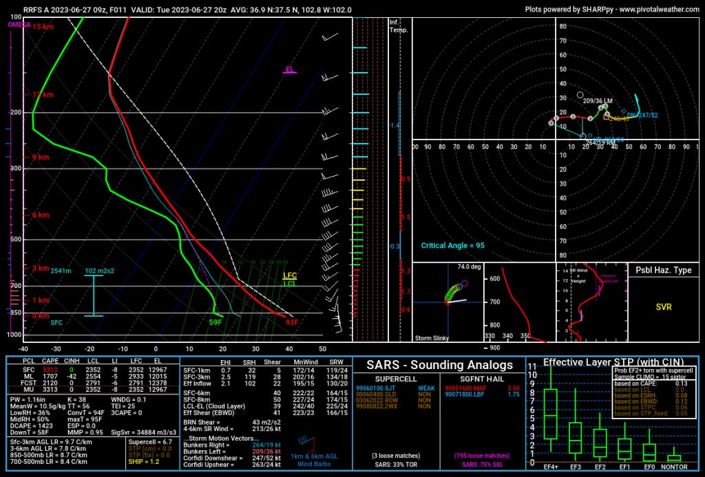
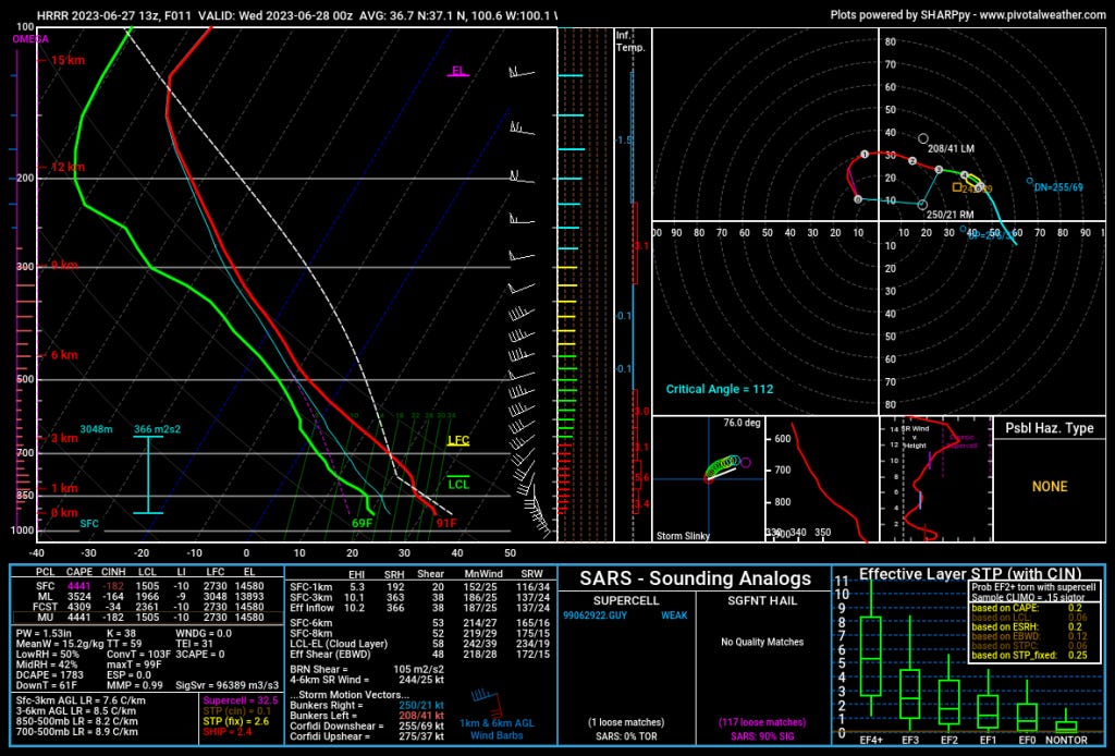
Storms are a certainty and as they grow upscale into the evening, an enhanced damaging winds threat is evident given the 1700+ DCAPE. Before that, hodograph shape, hail growth zone instability, and storm mode should support giant hail with initial storms/supercells.
I suspect we’ll have a few supercells develop initially but most will merge into a linear segment that tracks east along the OK/KS border. It is possible we’ll get a supercell or two embedded in the line, and there may be just enough help in the environment to support a very low tornado threat.
We’ll have another risk or two this week on the Central/Southern Plains. I’m not seeing any major risks, but there’ll be a few severe storms around. As always, subscribe to our newsletter and also be sure to check back here often.