

Enhanced Severe Weather Threat Tomorrow
Enhanced Severe Weather Threat Tomorrow
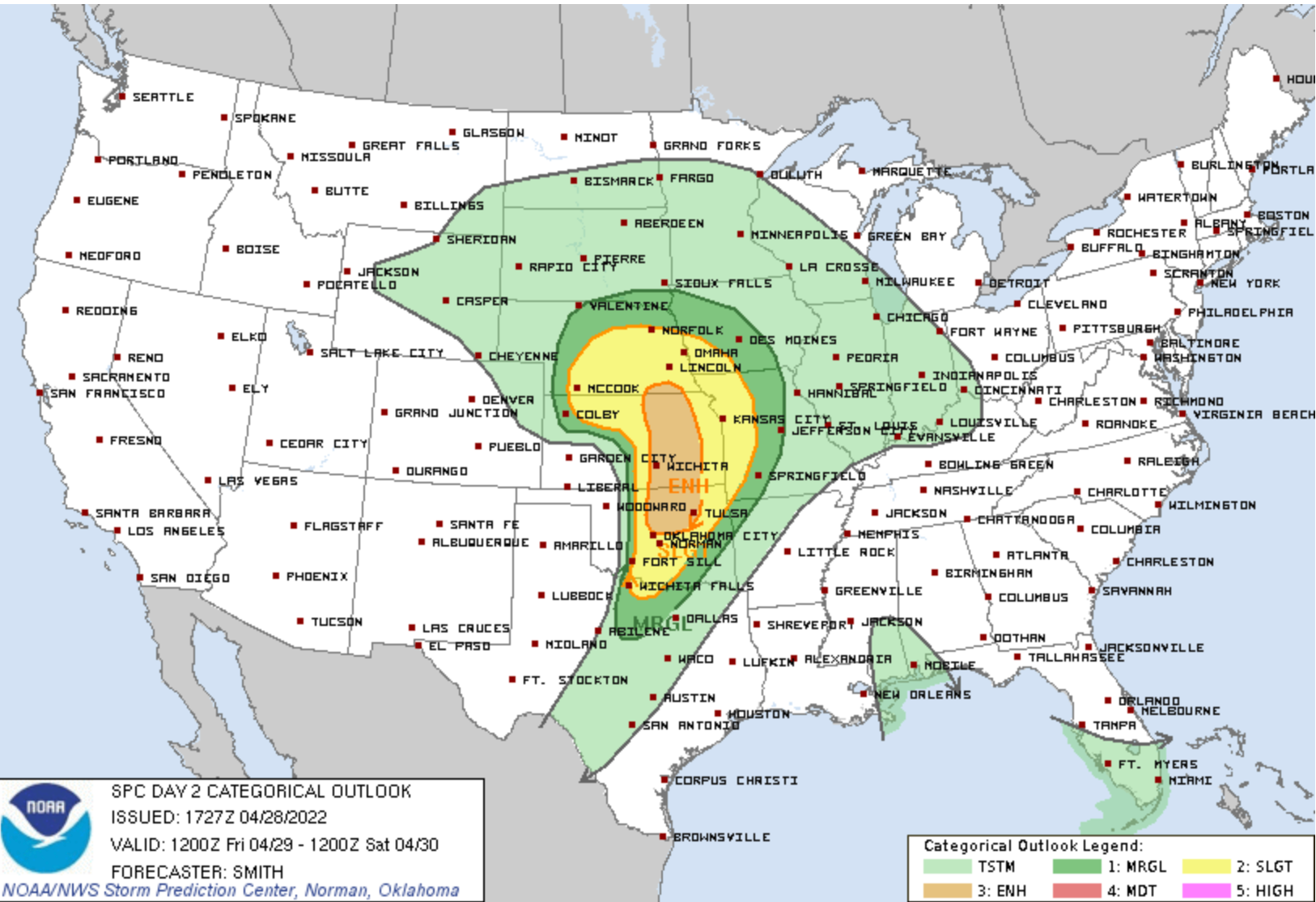
The risk spans from Nebraska to Oklahoma!
The heart of severe weather season is upon us, and the big risks over the Great Plains look set to really begin in earnest starting with tomorrow.
Tomorrow is going to be a very interesting day with a variety of factors that are both for and against a robust severe weather threat.
The things that are favorable include a sharp dryline, an upper level storm system bringing lift and increasing wind shear, and seasonally good surface-layer moisture levels surging northwards. All of these are ingredients we look for when severe weather is on the menu.
There are some factors that might not be as favorable. For starters, there remains a very strong capping inversion over the Great Plains. This layer of warm/dry air aloft is being sent over the surface layer by strong drought and heat in the southwest and has been present much of the season. Tomorrow will be no exception. Additionally, some (but not all) models are pointing to a less than ideal amount of surface moisture which, when combined with a strong cap, would make tomorrow a bit less favorable for strong tornadoes.

What we expect to happen is that strong heating and lift from the compact upper storm system will lead to a localized breaking of the cap somewhere from Northern Oklahoma into Southern Kansas. It is here where the best overall ingredients will lie. The key tomorrow will be when that cap breaks. The later it takes for storms to go, the less of a window there will be for severe weather to take place before the cap restrengthens as temperatures begin to fall near sunset.
Mesocyclones can often struggle to produce big tornadoes if they are having to fight through a capping layer in the lowest levels. It’s not impossible and it does happen often enough, but that is something to watch for tomorrow.
If storms can form by 4-5 p.m., a robust severe weather threat with tornadoes and giant hail will certainly develop. If moisture is slightly lower than forecast or if the upper level storm system is behind even by a couple of hours — then the look of tomorrow will change dramatically.
Looking ahead
We won’t spend much time on it, but I wanted to note that we’re following more storm chances on Sunday/Monday on the Plains.
Stay tuned to our Instagram and TikTok for the latest on our chase thoughts and trip updates!