

⚠️🌬️ Enhanced Severe Threat Today, Southwest NonSoon Continues
⚠️🌬️ Enhanced Severe Threat Today, Southwest NonSoon Continues
Plus two educational videos for you!
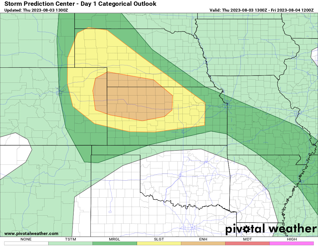
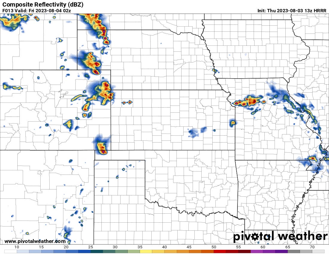
There should be several severe storms with damaging winds the main threat today from E. Colorado into Kansas and W. Nebraska.
I’m not seeing a tornado threat today really. As flow increases next several days I suspect we’ll have a few severe wx chances over the Central and maybe even Southern Plains.
August Outlook
It appears that much of the country will remain active in August, except for the areas that need the rain the most in August: the desert Southwest.

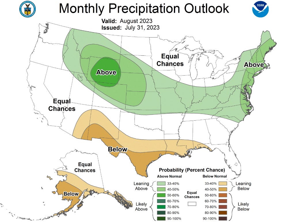
Overall, I suspect we’ll see an uptick in severe weather events further south off of the front ranges on the Central High Plains, which we’ll be keeping a close eye on. The monsoon season this year looks to definitely finish below average, but I wouldn’t rule out a furious and active burst towards the mid-late portions of the month.
Two Videos to Learn From
Our YouTube channel remains active these days. We focus a lot of our work there on current weather and education on severe weather, forecasting, storm structure/behavior, photography, and storm chasing. Here are two videos you should absolutely check out as a sample of what we have coming in the next several months:
Guide on Instability: When to Use What CAPE
Five Tornado Hunting Secrets
Be sure to subscribe to our channel! And we’ll see you next time.