

Drought Expands, Storm Activity Stays East
Drought Expands, Storm Activity Stays East
What does the rest of April have in store?
If you were looking for a classic La Niña weather pattern, you’d be hard pressed to find something more classic than what we’ve been experiencing for much of the last 6 weeks or so.
Last week we saw severe weather shaded well east from Iowa down to Arkansas and into the southeast. Meanwhile, the traditional Tornado Alley of the Great Plains (northern Texas to the Dakotas) saw wildfires and continued strengthening drought.

While the above map isn’t fully updated with the most recent severe storm activity just yet, the overall tone wouldn’t change. See all of that empty white space over the Great Plains? That’s a sign of a strengthening drought as we continue through Spring.
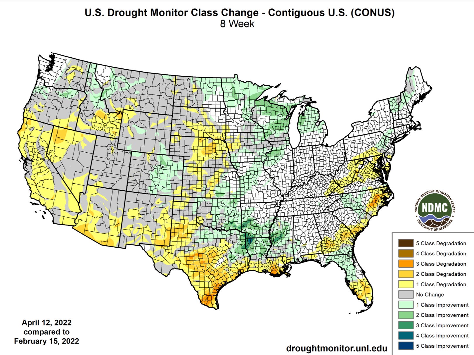
Indeed, drought conditions are largely worsening across much of the Great Plains, with some areas seeing as much as three classes of degradation so far this Spring.
We saw the initial impacts of what strengthening drought does to the severe weather season on the Plains with a ultra strong cap preventing storm formation on the dryline this last week — as well as the dryline itself moving way east, leaving much of the Plains in a dry/windy environment. Both of these could remain features of the season as we move into May.
So what does the rest of the month have in store?
The Rest of April Looks Only Slightly Different
We will start April with an approaching upper-level trough towards the middle of the country. Unfortunately for the drought-stricken areas, this storm looks to take a more northerly and faster path through than it appeared on earlier model runs, which will limit the rainfall potential.
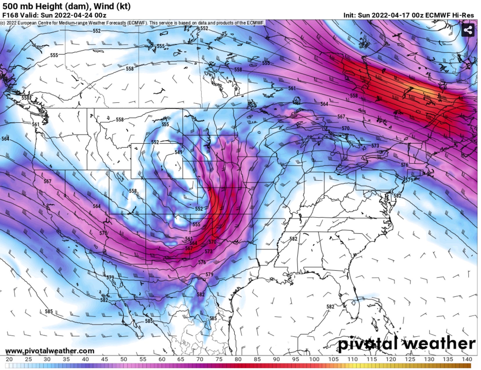
This trough will likely help fuel severe weather chances on Friday and Saturday this next week, with another departing trough giving low end storm chances to the Plains on Tue-Thursday. Moisture will be pretty limited this week, which will mitigate the tornado potential somewhat on the Plains.
As this system passes through, it will drag down a cold front which will put much of the Plains in a cooler/drier pattern overall for the next week or so.
This will change in the final days of April as yet another storm system makes its approach towards the Plains for the turn of the month. The severe weather chances with this system may be higher as we go into May as our source of moisture will not be completely scoured in the wake of this week’s system and it will also have had ample time to recover and build before the next storm system approaches. May could start off very active.
As always, stay tuned to this newsletter and our social media feeds for our very latest thoughts on storm chasing setups when they eventually come around.