

Busy two days of Severe Weather
Busy two days of Severe Weather
A risk on the eastern parts of the Plains today, southeast tomorrow
The system we’ve been watching on social media has slowed slightly and is now going to happen on the easternmost portions of the Plains, at least initially.
A big storm system is ejecting out, and that will mix with ample moisture and instability to create a threat of severe storms starting this afternoon.
Today: Eastern Southern Plains Under Threat
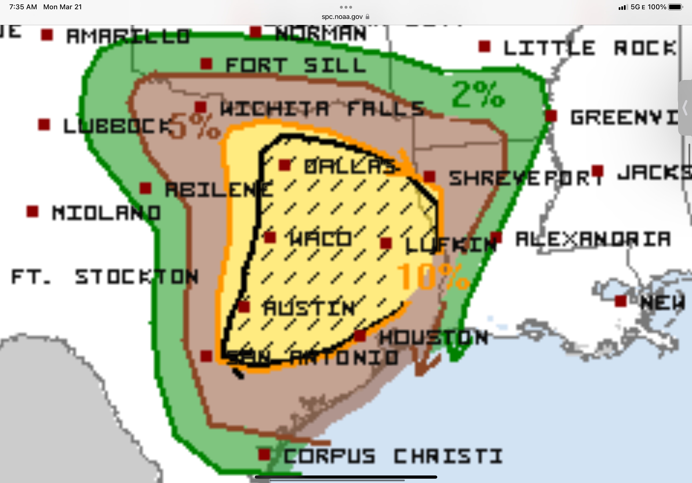
Today’s threat will center on an arcing dryline across Texas, where severe storms, including supercells, will take shape.
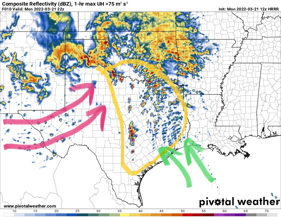
Expect storms to begin to form around early afternoon across eastern Texas, some of these could pose a severe weather risk with tornadoes possible. Amother set of storms will form on the dryline to the west no later than late afternoon — and depending on how isolated storms end up, these could pose a risk of strong tornadoes into the evening and overnight hours. Further NW into western north Texas and southwest Oklahoma, storms could pose a threat of isolated tornadoes and hail. Ingredients and storm mode here won’t be as favorable as further south and east. A lot of major population centers find themselves in the risk area today, so be sure to have a source of warning info later today.
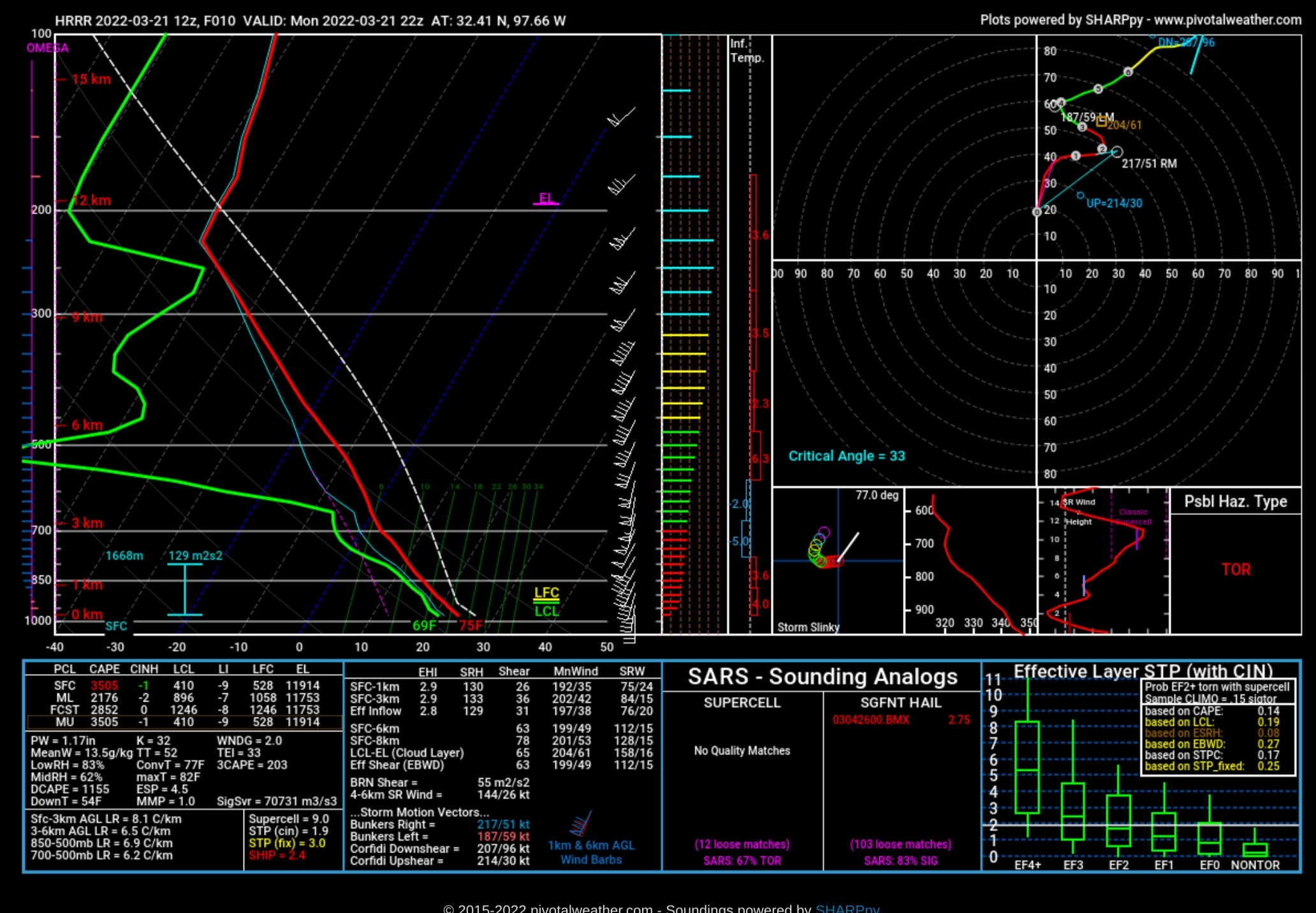
Soundings in the mid-afternoon show smaller hodographs at 0-1km with the shear vectors more parallel to the dryline than perpendicular. This will likely result in clusters of storms initially which struggle to rotate hard.
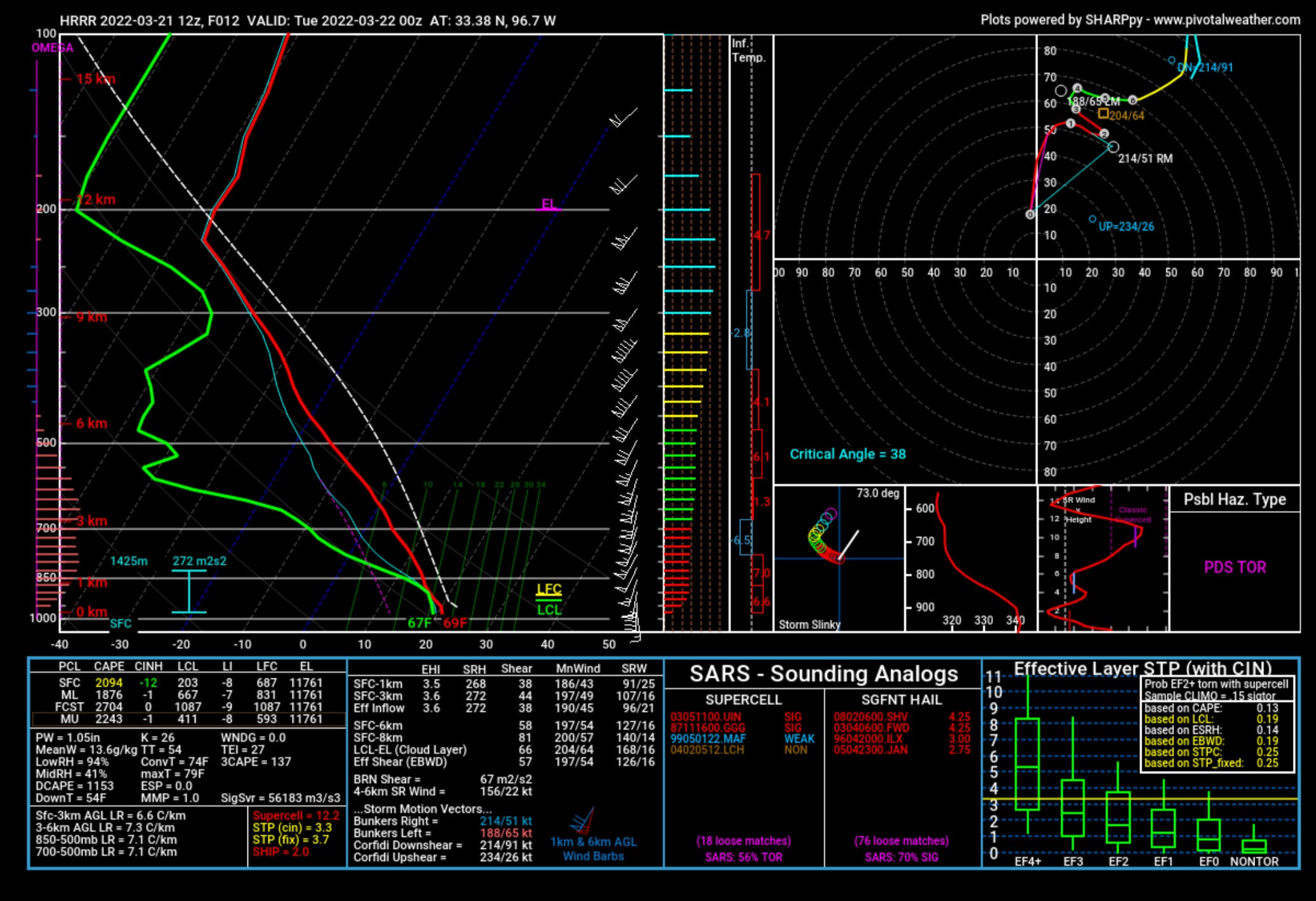
Wind profiles should continue to strengthen into the evening, with the shear vector also modestly improving with time. The low level jet is slightly displaced to the east of the dryline, so storms should move into a better environment with time as well. The backing in the lowest 3km with height gives me pause, as that’s usually not a feature of big tornado days, but the environment in the lowest 1km looks primed for any isolated storm to produce tornadoes in Texas, especially as the day goes on. The key thing to watch today will be how initial storm mode goes and how that might affect the day overall.
Tomorrow: Southeast
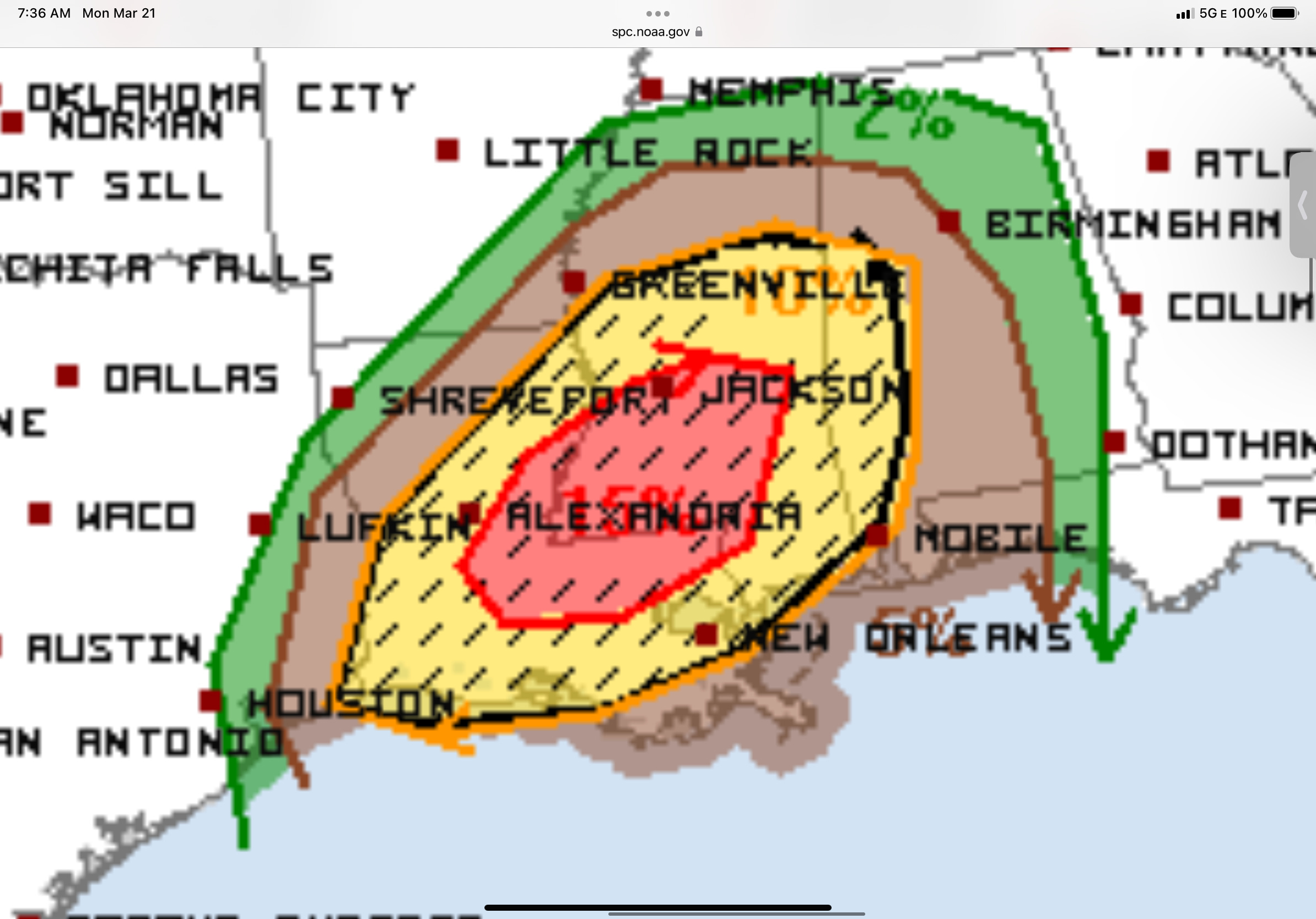
I won’t spend a ton of time on the southeast tomorrow, only because it is kind of simpler and also more than a day away and much can change. The tornado threat is forecast to be higher by the Storm Prediction Center, and the environment certainly looks more conducive.

Today’s storms will eventually form into a line that will be well established by tomorrow afternoon and marching east. Some tornadoes could happen along that. Of greater concern will be the area in the red circle ahead of the line. If storms can go here and remain isolated, they will pose a risk of strong tornadoes tomorrow.
As always, we talk about these setups on our social media profiles, particularly Instagram. Be sure to follow us there!