

A look at the week ahead
A look at the week ahead
Severe weather chances enter the picture today and before shifting east of the Plains on Wednesday.
A big upper storm system will emerge onto the Plains early this week, bringing with it the threat of severe storms over multiple days. The day with the most potential is Tuesday, which we’ll spend a bit of time on in this newsletter — but let’s break down Sunday and Monday first.
Today (Sunday)
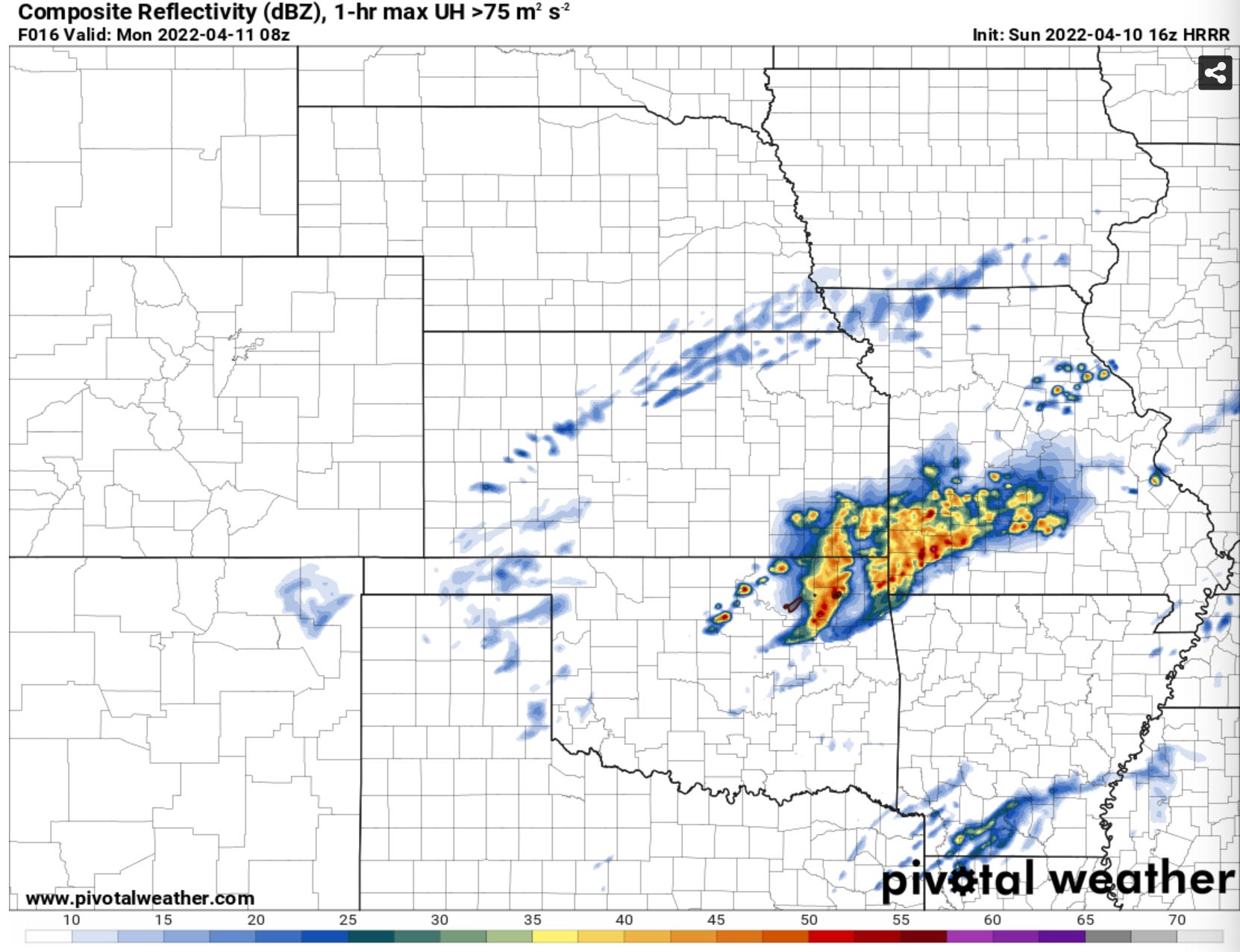
There’s not much to share today honestly. Storms will form late in the day and go into the overnight across NE OK into Missouri. A rogue tornado along the front edge of an advancing line is possible — but damaging winds and hail will be the primary threats.
Monday
A pretty robust environment will set up east of the Plains in Arkansas on Monday, where I think we could see a pretty localized but notable severe weather event. For the Plains, a front will sag south with a dryline trailing south and west from that in north and central Texas. Capping is going to be pretty strong and forcing pretty weak across Texas down the dryline. If a storm manages to go, it’ll have enough instability to work with to go severe, but the ingredients are not that great for robust supercells down the dryline.

Tuesday
The day capturing the attention of storm chasers is Tuesday — mainly because it has a lot of things you look for in a big severe weather day. There is an expansive dryline from Kansas to Texas, there is a storm system approaching from the west, and there is a decent warm sector east of the dryline.

The wind shear decreases as you go south from Nebraska and Kansas — to levels barely supportive of supercells by the time you get to Texas. Conversely, the best moisture and instability resides in Texas and decreases with time to the north.
Apart from that, there is a capping inversion that is going to need a lot of mixing and heating and/or an upper level wave to overcome in the afternoon. Models tend to depict the mass response to the upper wave being pretty weak through most of Tuesday, with weakly convergent winds on the dryline during the peak heating hours of the afternoon.

As such, most models are centering on a solution that produces little Precipitation across Oklahoma and Kansas with the bulk of afternoon activity across Texas where wind shear is much weaker.
A few small changes either way could really make or break Tuesday:
How much moisture mixes out along the dryline circulation will be important to getting storm formation. There is a middle-ground that needs to be reached here.
The cap is going to be a big question-mark by Tuesday. Most models are showing the cap strength we see today (very strong) should mostly maintain into Tuesday.
A small wave would likely be enough to get a storm or two going — which frankly, one of these may not be fully resolved on models as of today.
Assuming a storm can form, the mean scenario I forsee is a storm forming in a well mixed environment with temperature/dewpoint spreads initially unfavorable for tornadoes. As a storm moves east into better moisture and strengthening low-level wind fields, there would be a window for it to produce a tornado before the cap begins to kill the storm. I would assume storm formation is most likely 4-6 p.m. with storm death likely to follow by 7-8 p.m.
As always, stay up to date with our thoughts on upcoming severe weather setups by checking out our Instagram stories.