

A busy week of storm systems 😵💫
A busy week of storm systems 😵💫
Today begins what might be a pretty busy week for weather watchers.
The upcoming seven days will feature two storm systems with various regional impacts. Severe weather AND winter weather are possible depending on your location.
In other words, it’s Winter.
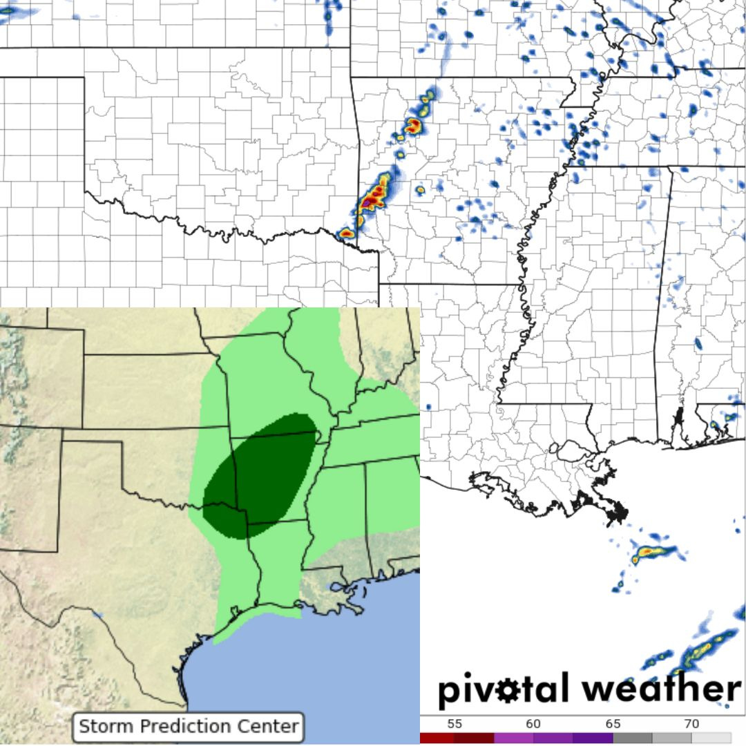
Today
Short-range high-resolution models are in good agreement that a few storms will form after dark tonight along/ahead of a cold front moving south and east through the Southern Plains. This front will also be responsible for the severe weather threat that will continue through the night and into tomorrow (more on that later today).
Forecast soundings from this area show a slight chance that a storm or two could be rooted near the surface — but generally, it is more likely that storms will be ingesting air parcels from a more elevated position, making the tornado threat very, very low. There is enough instability, and the shear profiles are such that some large hail will be the primary threat with storms tonight in this region.
Storms should weaken with time before firing anew tomorrow along the surging front. It's a pretty standard day, but if you live in the region, you should PROBABLY make sure that car is parked under something if you can
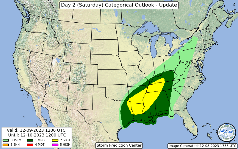
Tomorrow
There is a broad risk area for tomorrow, running from East Texas to Kentucky. Within this region, storms should fire along an advancing cold front in the afternoon.
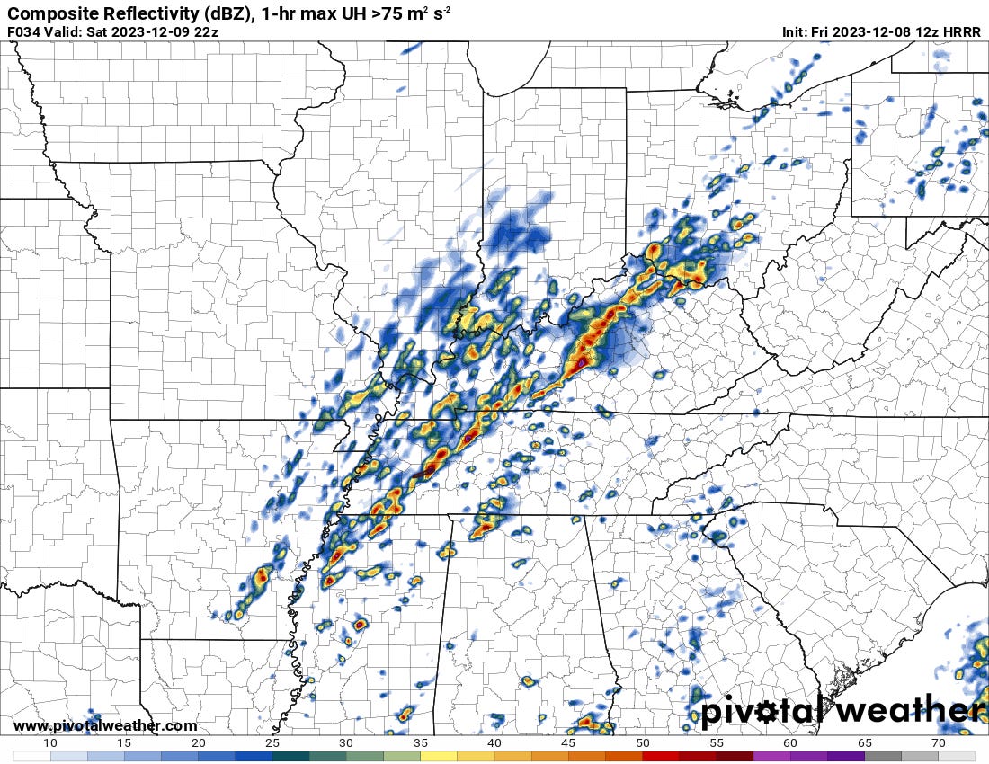
A look at weather models tomorrow shows scattered storms along a long frontal zone in the Mid-South. Some of these storms will undoubtedly be supercells, but given the shear vector being almost entirely parallel to the front, we will definitely see mixed storm modes.
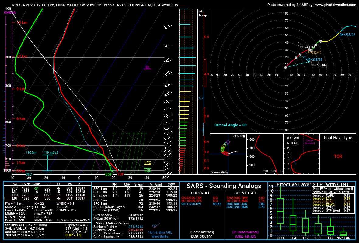
I pulled several soundings from the region tomorrow during the afternoon, and the hodographs look pretty straight with minimal curvature even into the night hours. This unidirectional shear isn’t usually the producer of significant tornado events, but if winds back locally anywhere with a favorable storm mode, everything else is kind of there.
The 3CAPE being over 100 mixed with uncapped surface parcels leads me to believe that a tornado or two is not out of the question tomorrow if a supercell can get going.
The Winter Side
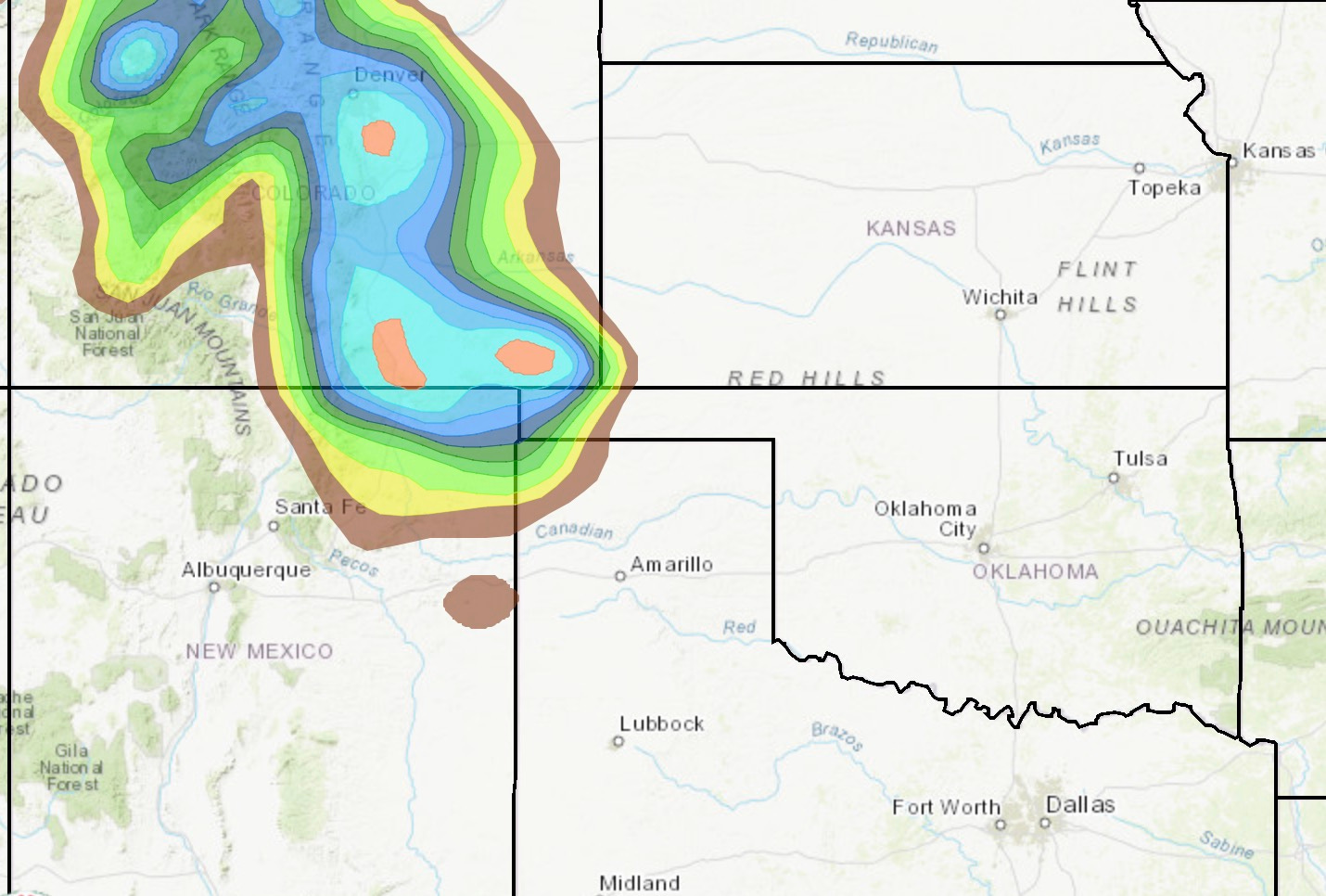
The map above shows how likely it is to get 1” of snow or more from this current system. The totals overall look to be in the 1-4” range from this system. This isn’t a major event by any stretch, but some slippery roads could happen along I-25, especially from the Raton Pass to Denver.
Next Week
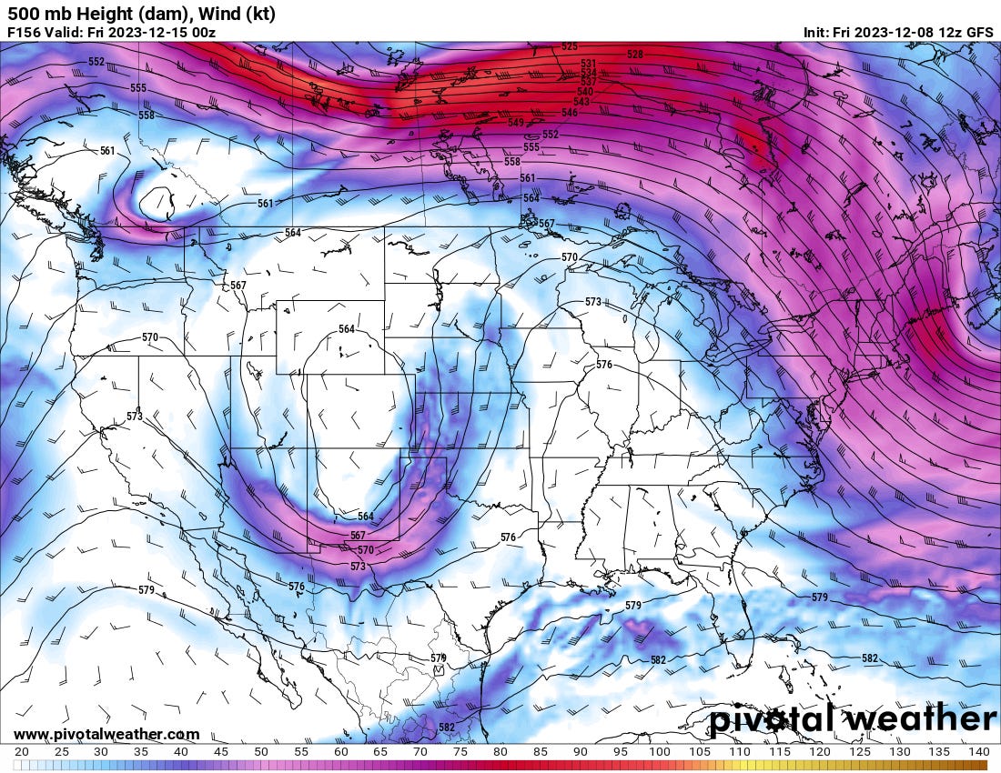
We’re close enough to next week now to really start giving models some credence on a few things.
There will almost certainly be a storm system moving into the middle of the country, given the model agreement. The Euro and GFS (and ensembles) show this as the case.
Given the time of year, there will be winter weather impacts on the cold side of the system.
Both models eject this trough out slowly. Heavier snowfall totals and better chances of solid/beneficial rainfall are possible.

A look at the WPC QPF map shows a pretty solid bullseye of precipitation across Texas and into adjacent portions of Oklahoma and New Mexico. We’ll have to monitor potential winter weather impacts with this much moisture possibly falling.
Want to Partner With Us?
We are currently seeking up to five storm chasers or chase teams to partner with for the next year on an exchange/mentorship program that we are very excited about.
The simple version of what this program wants to be is simple: We want to partner with newer/up-and-coming storm chasers to share knowledge and content.
Sound like your cup of tea?